Why Should the Taihang Mountains Be Regarded as the Backbone of China?
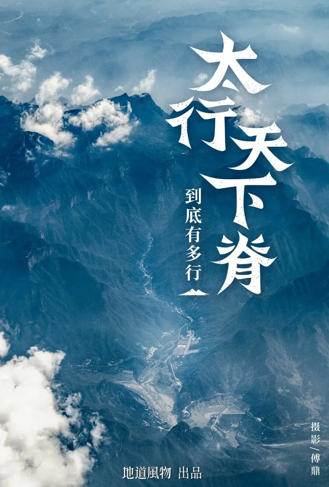
People from Shanxi, Henan, and Hebei say: When you feel down, go to the Taihang Mountains!
Though said in humor, the Taihang Mountains indeed contain immense energy: they are a geographical range, a cultural range, and a spiritual range.
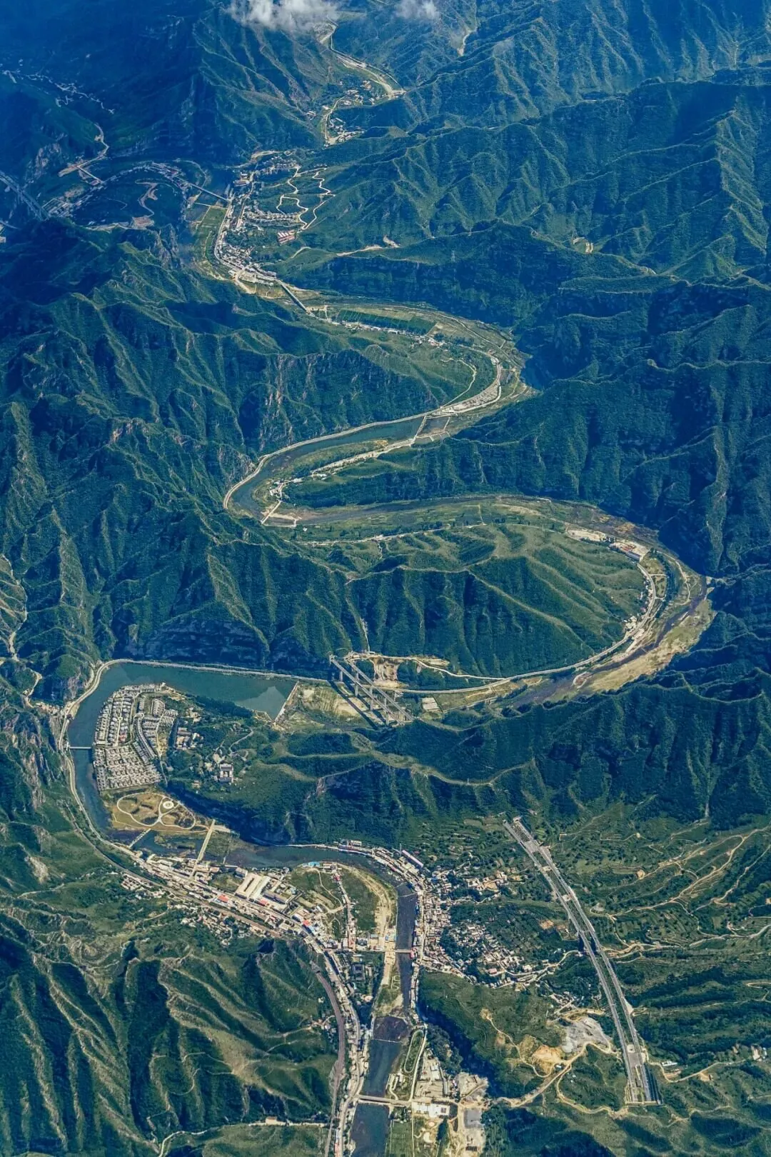
The Juma River winds its way through the Taihang Mountains.
The uplift of the Taihang Mountains promoted the formation of the North China Plain and the birth of many basins in Shanxi. It is the mother mountain of people in Shanxi, Hebei, Henan, and other regions.
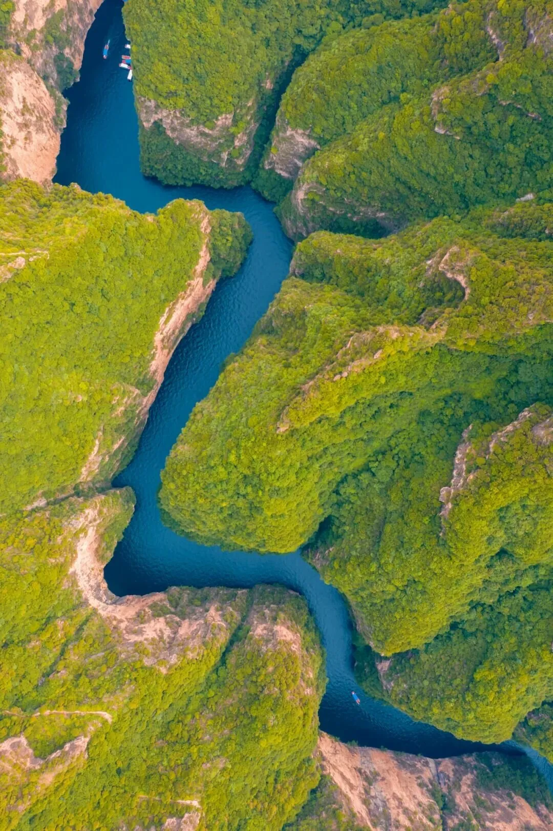
In Baquan Gorge of the Taihang Mountains in Changzhi, the river appears azure and meandering.
The Taihang Mountains nurture numerous rivers and serve as the "Three-River Source" of the North China Plain, nourishing the homes of people in Hebei and Henan, and providing the source of life for ancient cities such as Beijing, Anyang, Lingshou, Handan, and Yecheng.
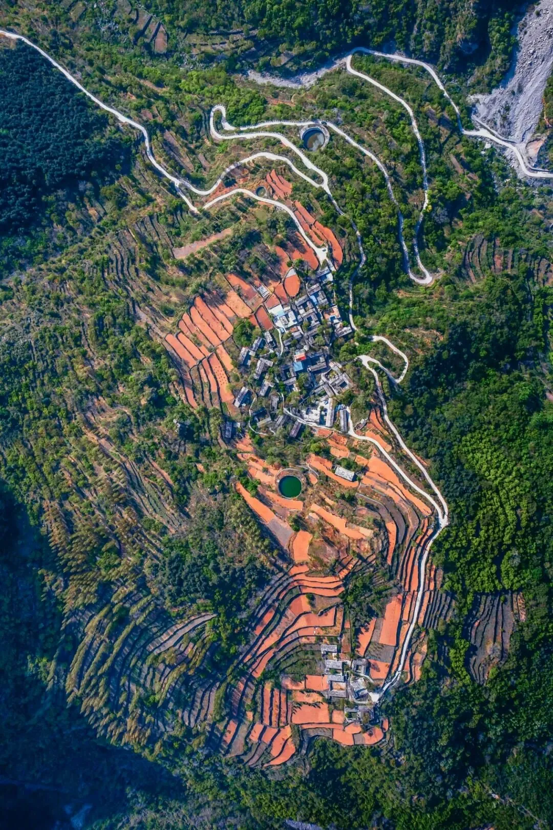
Danao Village, Shibanyan Town, Linzhou City, Henan Province,
Residents on the Taihang Mountains use circular pools to store water.
The Taihang Mountains are also a legendary range with spiritual power. Here lies the tale of the Foolish Old Man who moved mountains, the Eighth Route Army established the Jin-Cha-Ji revolutionary base to resist invasion, and the people of Henan built the cliff-hanging "Sky Road" and the "Artificial Heavenly River" — the Red Flag Canal.
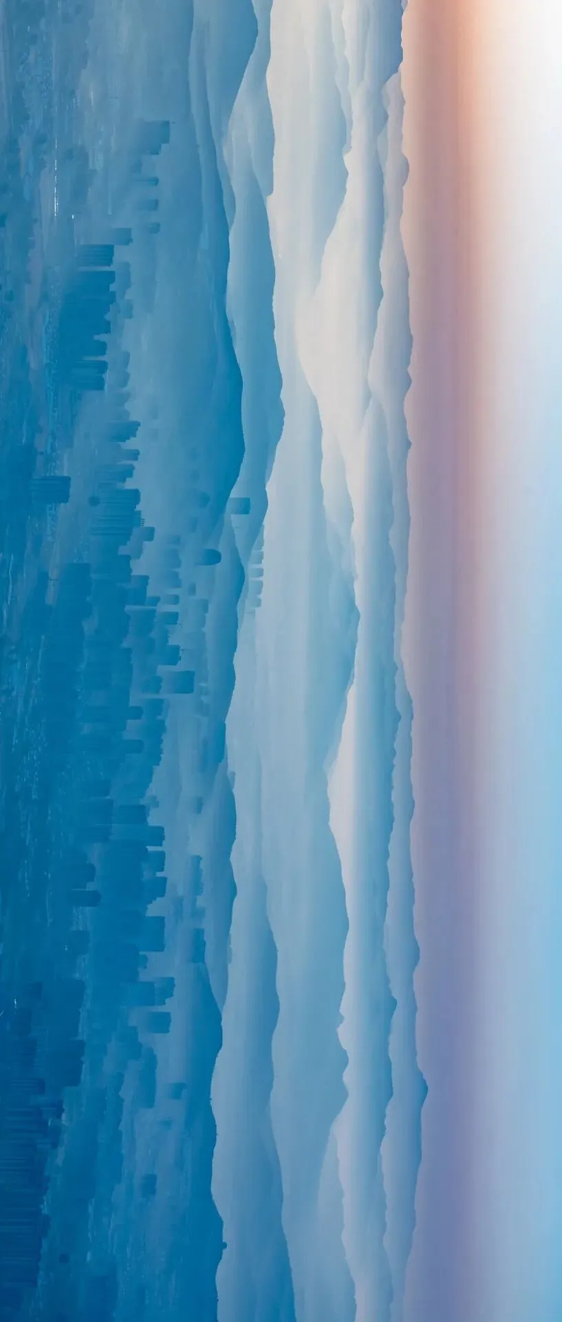
The city of Linzhou at the foot of the Taihang Mountains resembles an ink wash painting.
The Taihang Mountains are China's north-south spanning backbone and the "aerial home" of the people in Henan, Hebei, and Shanxi.

Why are the Taihang Mountains called "China's Backbone"?
The Qinling and Taihang Mountains together form the central framework of eastern China. Like the Qinling, the Taihang is not "a single mountain."
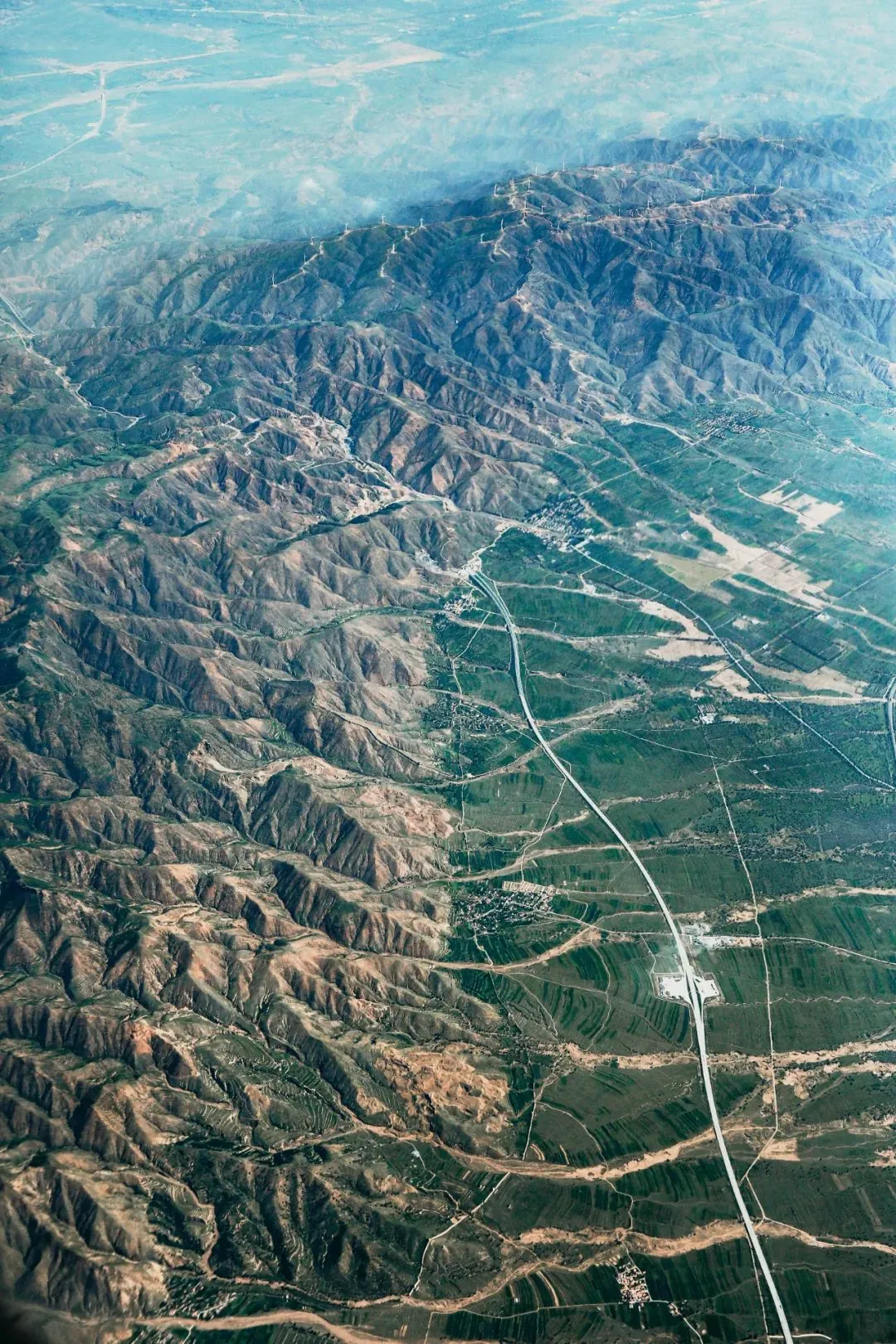
Rather, it is a continuous range composed of numerous mountains.
The Taihang Mountains stretch across four provinces and municipalities: Beijing, Hebei, Shanxi, and Henan, with a total length of about 400 kilometers. If including its extensions, the total length reaches 1,000 kilometers. The broad Taihang mountain system actually gathers many famous mountains:
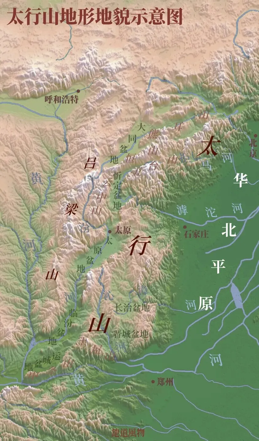
Schematic diagram of the Taihang Mountains' topography and landforms,
The Taihang Mountains span regions including Shanxi, Henan, Hebei, and Beijing.
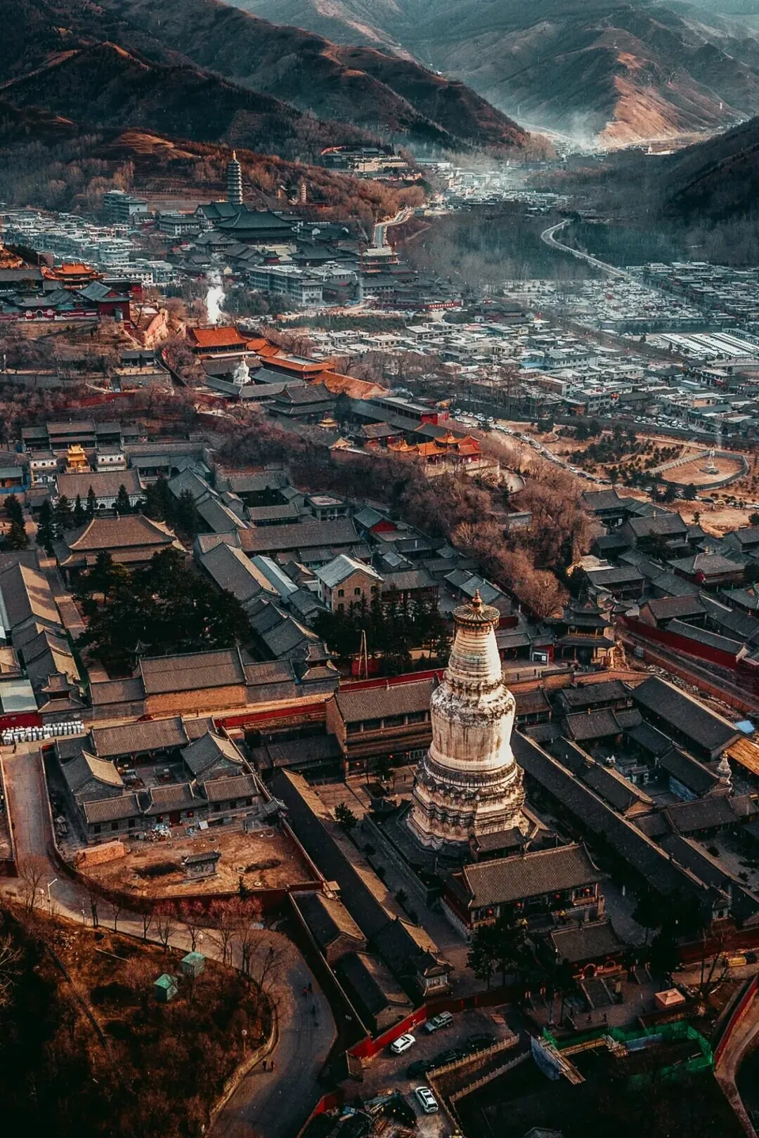
Mount Wutai ranks first among the four great Buddhist mountains,
Holding a supreme status in the Buddhist circles of China and even East Asia;
Mount Yuntai was the retreat of the Seven Sages of the Bamboo Grove,
It offers Chinese people another possibility for the spiritual world.
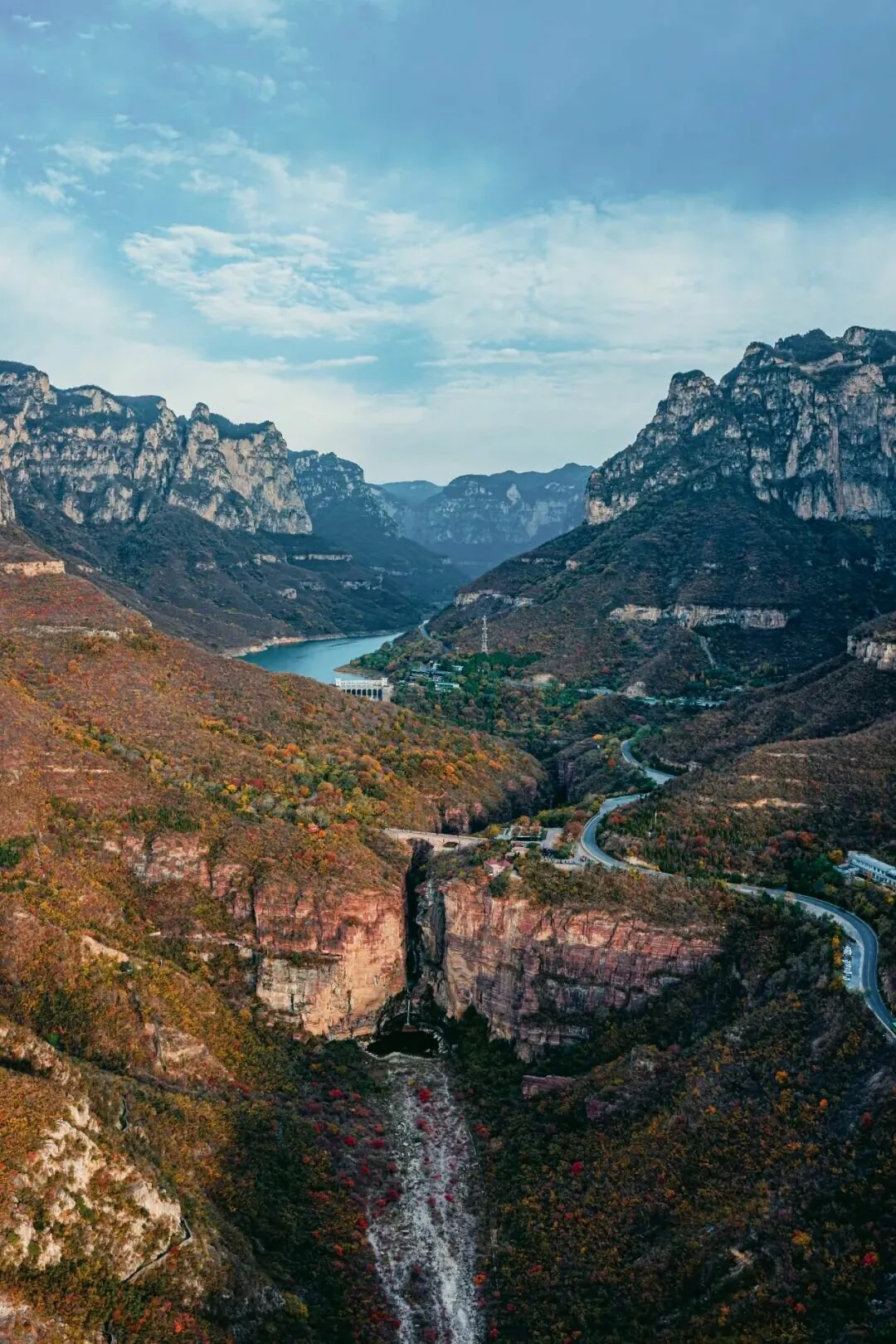
The Red Stone Gorge of Yuntai Mountain integrates the beauty of grandeur, peril, wonder, and seclusion.
The Wangwu Mountain is a branch of the Taihang Mountains, traditionally believed to be the site where the Yellow Emperor offered sacrifices to heaven.
During the Han and Wei dynasties, it became known as the "First Blessed Cave Heaven" of Taoism.
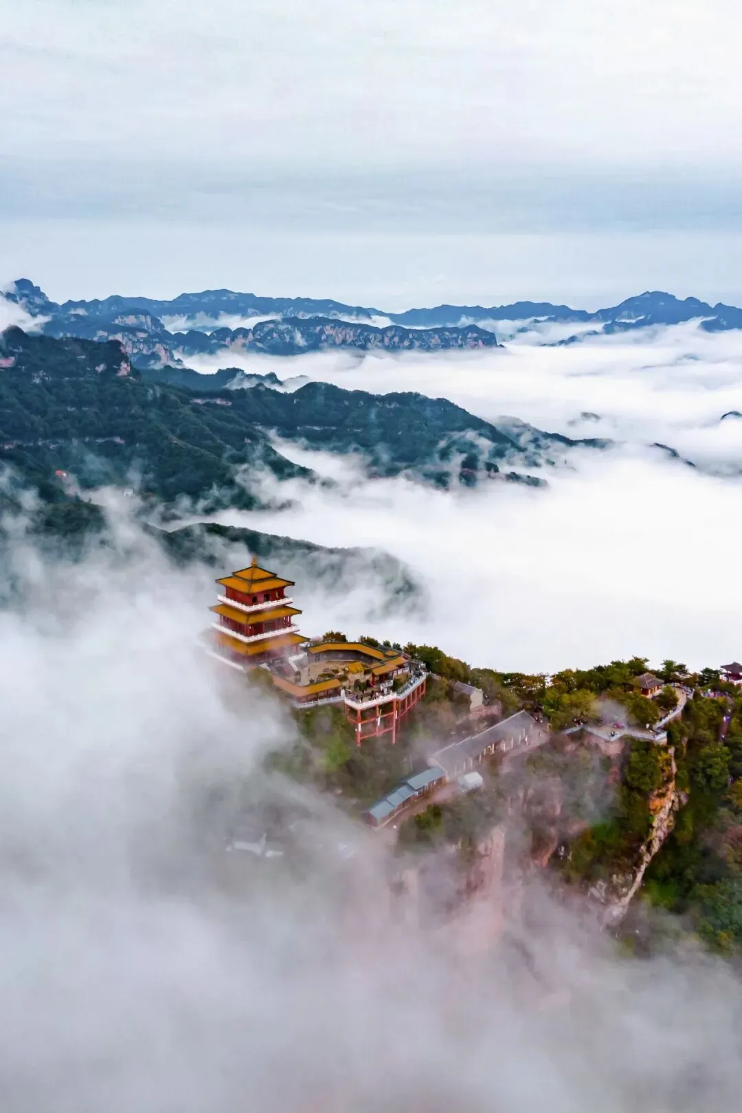
The Wangwu Mountain Altar, the "First Taoist Cave Heaven" standing above the clouds.
"Tai" — even greater than "great." The name Taihang was likely given by an ancient Hebei resident, as the mountain range before them was truly immense and towering. The majestic Taihang, vast and expansive, accommodates numerous famous mountains and great rivers.
If the east-west spanning Qinling Mountains are the critical range separating China's northern and southern climates, then the north-south traversing Taihang Mountains mark the significant divide between Highland China and Lowland China.
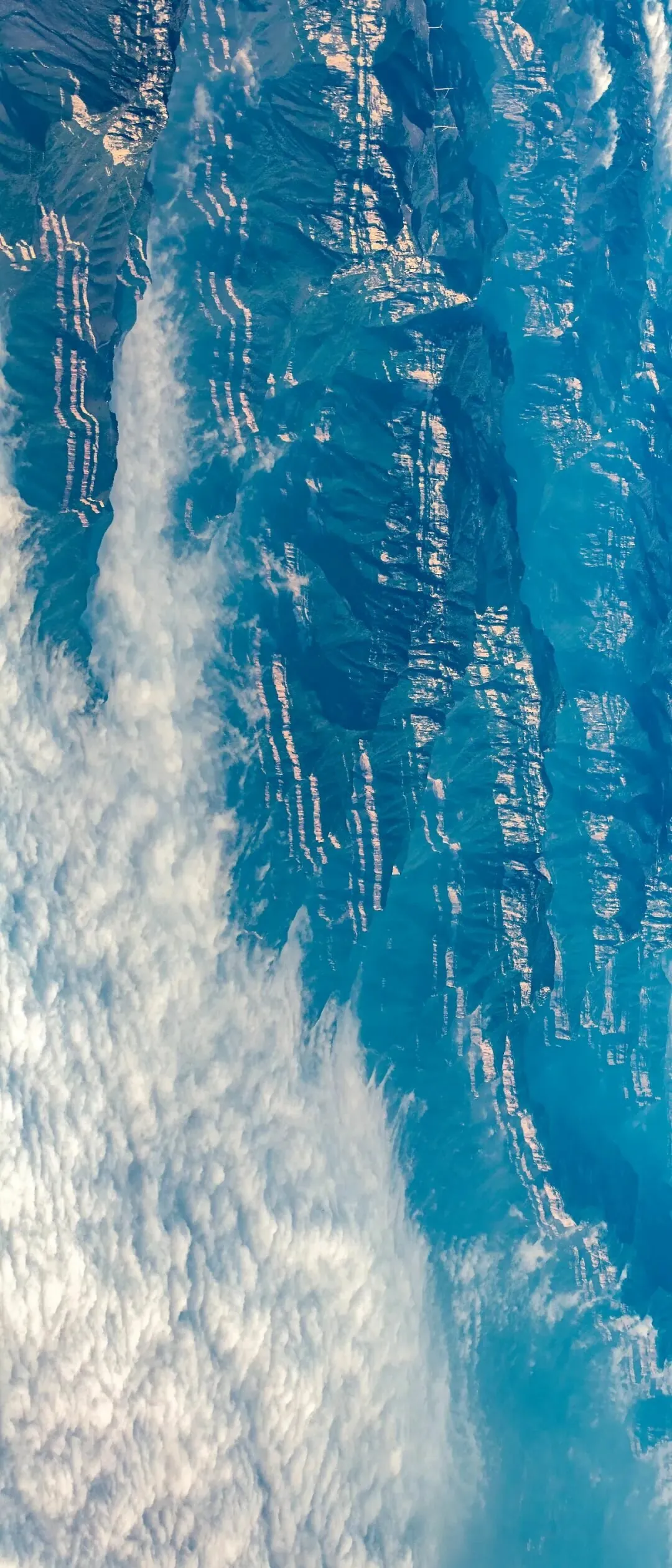
Yet it is sufficient to form a barrier between Shanxi, Henan, and Hebei.
Geomorphologist Zeng Zhaoxuan simply divided China's topography into two parts: Highland China and Lowland China. The boundary between these two parts aligns with the Greater Khingan Range, Taihang Mountains, Wushan Mountains, and Xuefeng Mountains—the division between China's second and third topographic steps. The Taihang Mountains lie at the center of this "backbone."
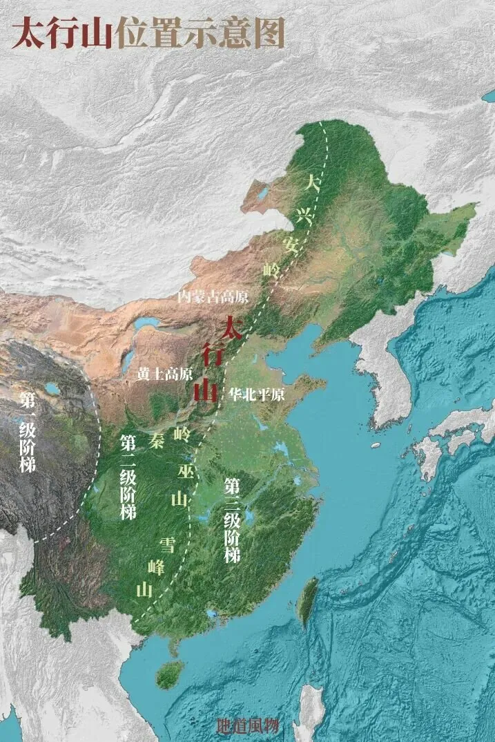
Schematic diagram of the location of the Taihang Mountains in eastern China.
In the geological structure of eastern China, there is a large fault zone. East of the fault zone, the crust continuously subsides, forming the North China Plain and the Middle-Lower Yangtze Plain. West of the fault zone, the crust uplifts, forming the Inner Mongolia-Shanxi Plateau and the Yunnan-Guizhou Plateau. The Taihang Mountains rose during this process.
In the intense geological changes, the Earth endowed the Taihang Mountains with three breathtaking wonders: tower peaks, canyons, and long cliffs, making it a rare giant geological park in the world.
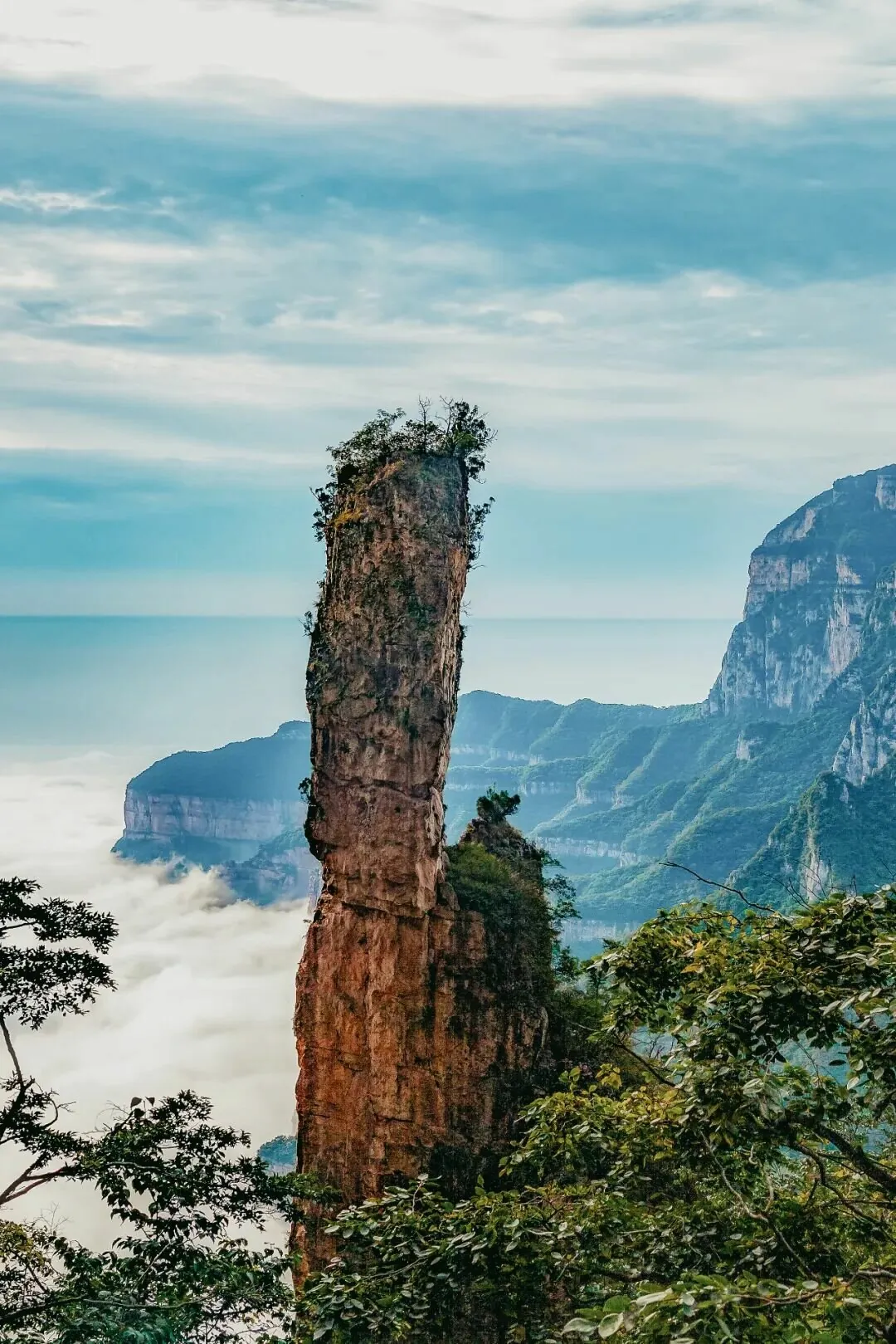
In Guan Mountain National Geopark in Xinxiang, Henan, tower peaks and cliffs echo each other from afar.
The winding Taihang Grand Canyon sees rivers seeking their way into the North China Plain. The towering peaks of Baishi Mountain, which separated Yan and Zhao during the Warring States period and divided two nations during the Liao and Song dynasties.
However, what makes the Taihang Mountains unique is its long cliffs.
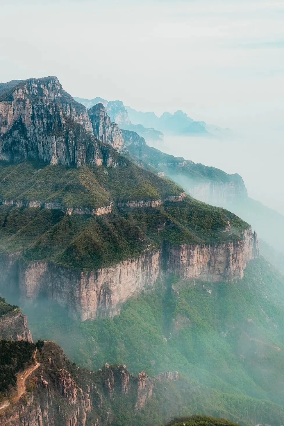
Near Huixian, there are many Taihang cliff landscapes with straight sections.
Especially in the middle section of the Taihang Mountains, red quartz sandstone forms multi-level horizontal cliff walls, the most iconic geological landscape of the range. Most famous in the Zhangshiyan area of Zanhuang, Hebei, it is also known as the "Zhangshiyan landform," one of China's three major sandstone landforms, alongside Danxia and Zhangjiajie.
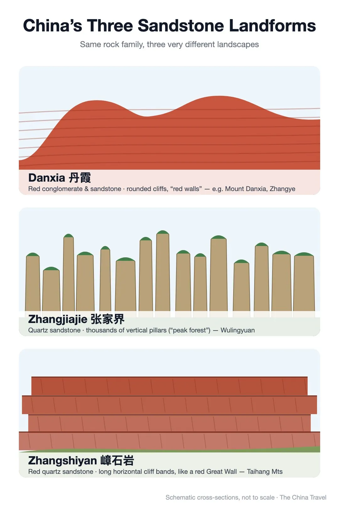
Schematic diagram of China's three major sandstone landforms.
Unlike the watery charm of Danxia or the extraordinary beauty of Zhangjiajie, the cliffs of Zhangshiyan resemble a tough northern man with unyielding strength, exuding a robust beauty.
The Taihang Mountains are not exceptionally high, with the 3,000-meter-high North Terrace of Wutai Mountain and the 2,800-meter-high main peak of Xiaowutai Mountain representing their height limits. Unlike the snow-capped mountains of the Tibetan Plateau, which win with elevation, the Taihang Mountains awe with the horizontally expansive momentum of their cliffs, like sections of a red Great Wall.
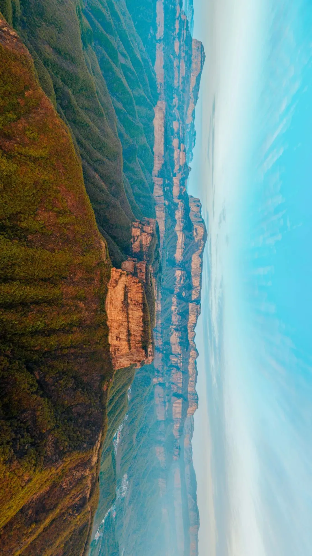
The horizontally unfolding cliffs of Mount Taihang's Zhangshi Rock are majestic and grand.
Mount Taihang not only showcases the rugged beauty of its rocks but also possesses the gentle, winding charm of its waters.
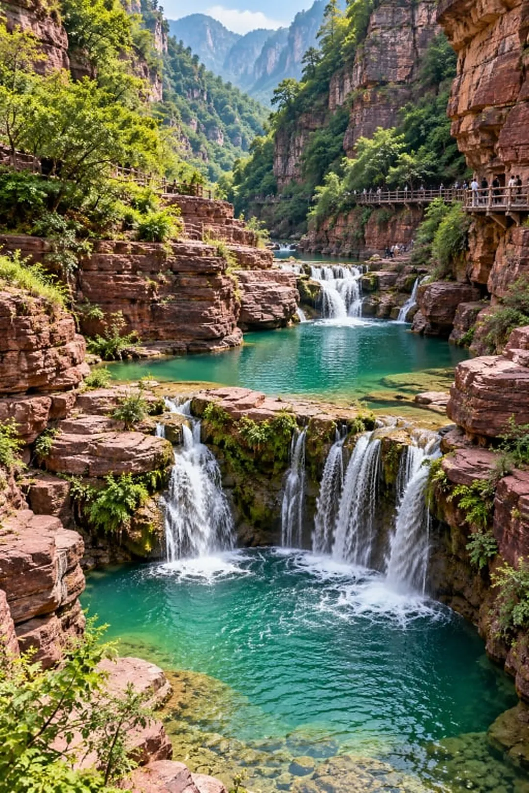
In the South Taihang's Yuntai Mountain Peak Forest Gorge, the pools are emerald green.
Taihang has bestowed its most beautiful section upon the South Taihang.
The 800-li majestic Taihang Mountain has many faces. Conventionally, it is divided into three parts: North Taihang, West Taihang, and South Taihang, corresponding to the sections in Hebei, Shanxi, and Henan provinces respectively.
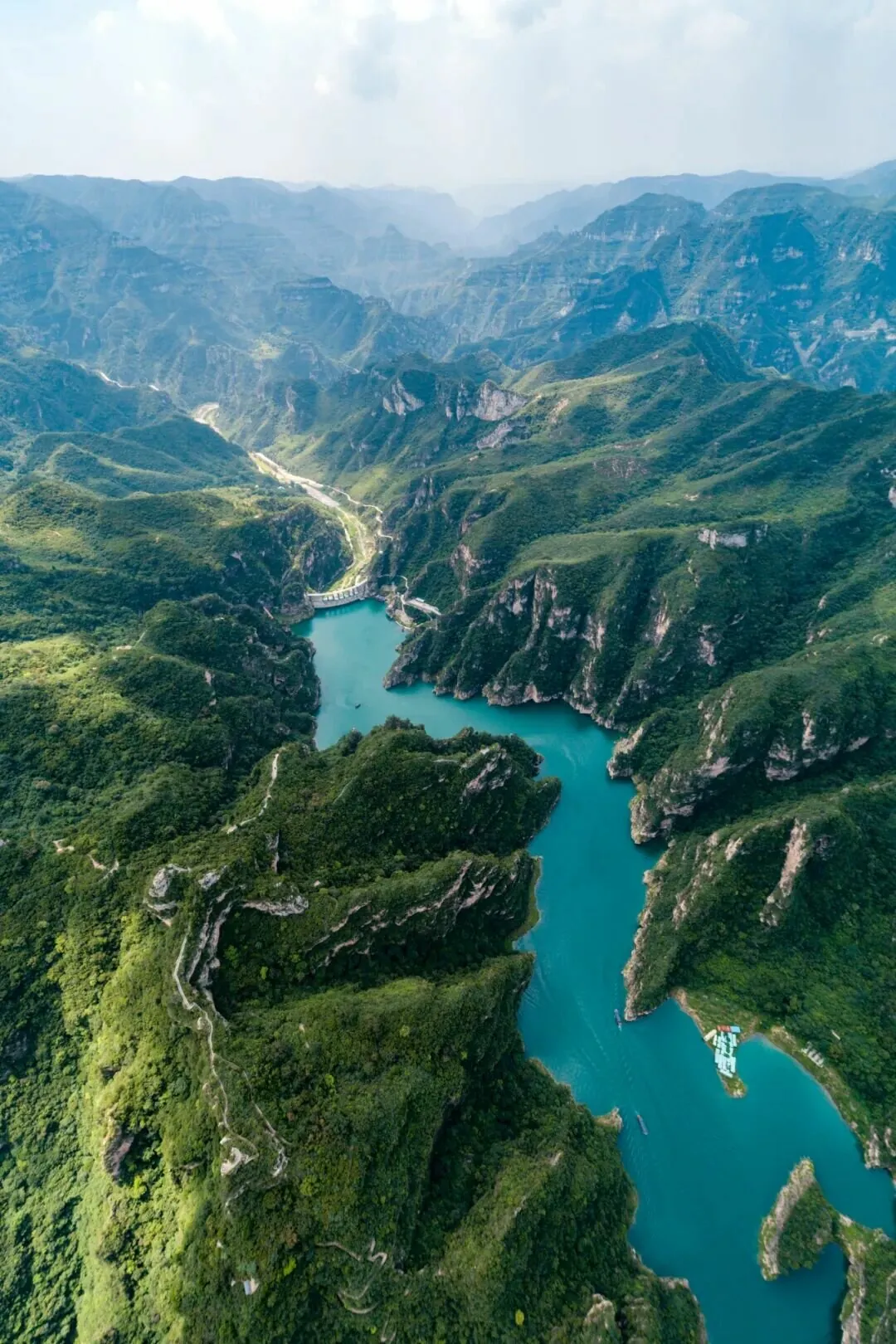
Qinglong Gorge in Jiaozuo, Henan, enjoys the reputation of being the "First Great Gorge of Yuntai Mountain".
They differ significantly in one aspect: North Taihang and West Taihang are relatively arid, while South Taihang is rich in water resources.
The extreme rainfall that occurred in Henan in July 2021 was related to Taihang Mountain. Stretching through the core area of North China, the Taihang Mountain blocks warm, moist airflows from the ocean, making rainfall more likely on the windward slopes east of the mountain range.
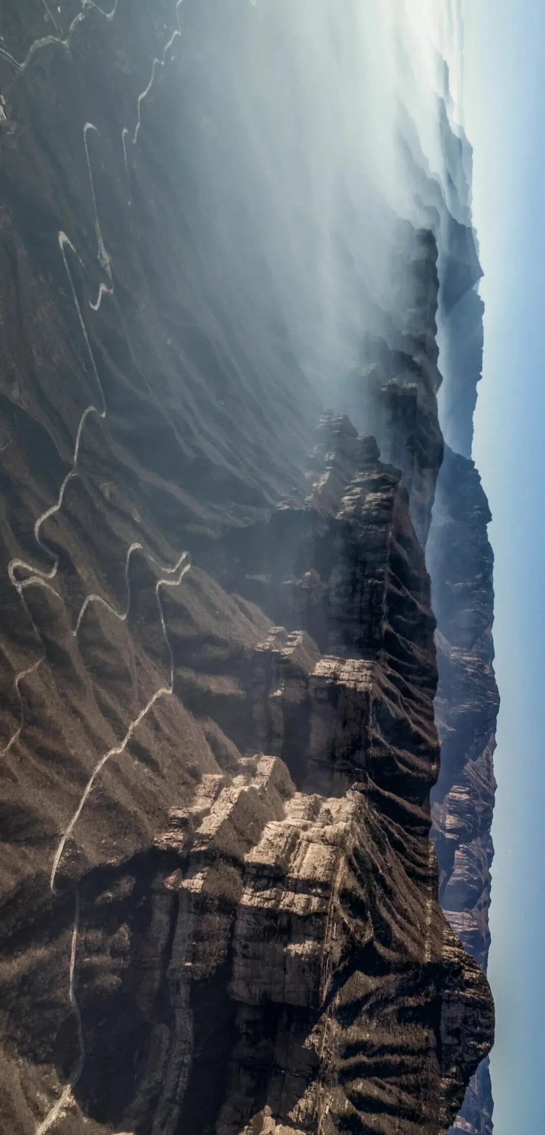
Linlü Mountain in Linzhou, Henan, blocks moisture from the North China Plain.
The areas of Xinxiang, Jiaozuo, and Jiyuan in South Taihang are rich in groundwater and feature numerous surface springs, earning the title "Underground Reservoir of North China". In places like Yuntai Mountain and Guoliang in South Taihang, there are many waterfalls with significant drops. Such dense clusters of waterfalls are rare in northern China.
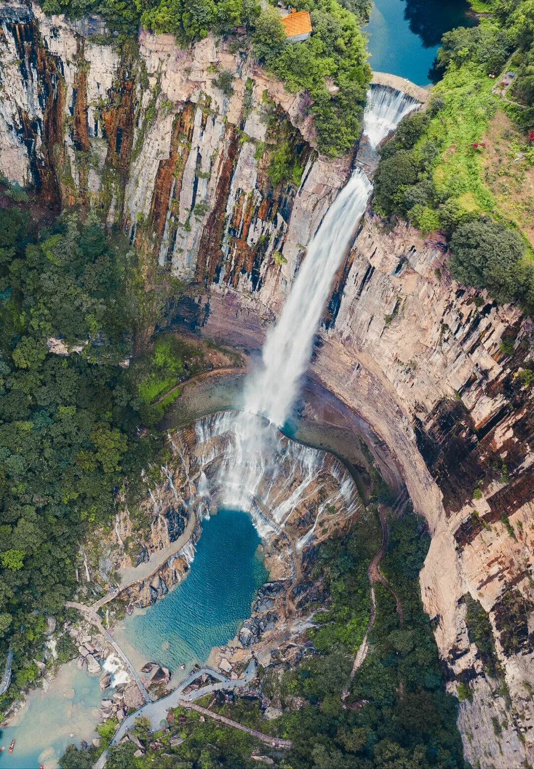
Baligou Waterfall in Xinxiang City is one of the few large waterfalls in North China.
Some say it is fitting that Taihang Mountain has given its most beautiful section to South Taihang.
Unlike many major mountain ranges that serve as watersheds for large river basins, many river systems in the Taihang Mountain cut directly through the range.
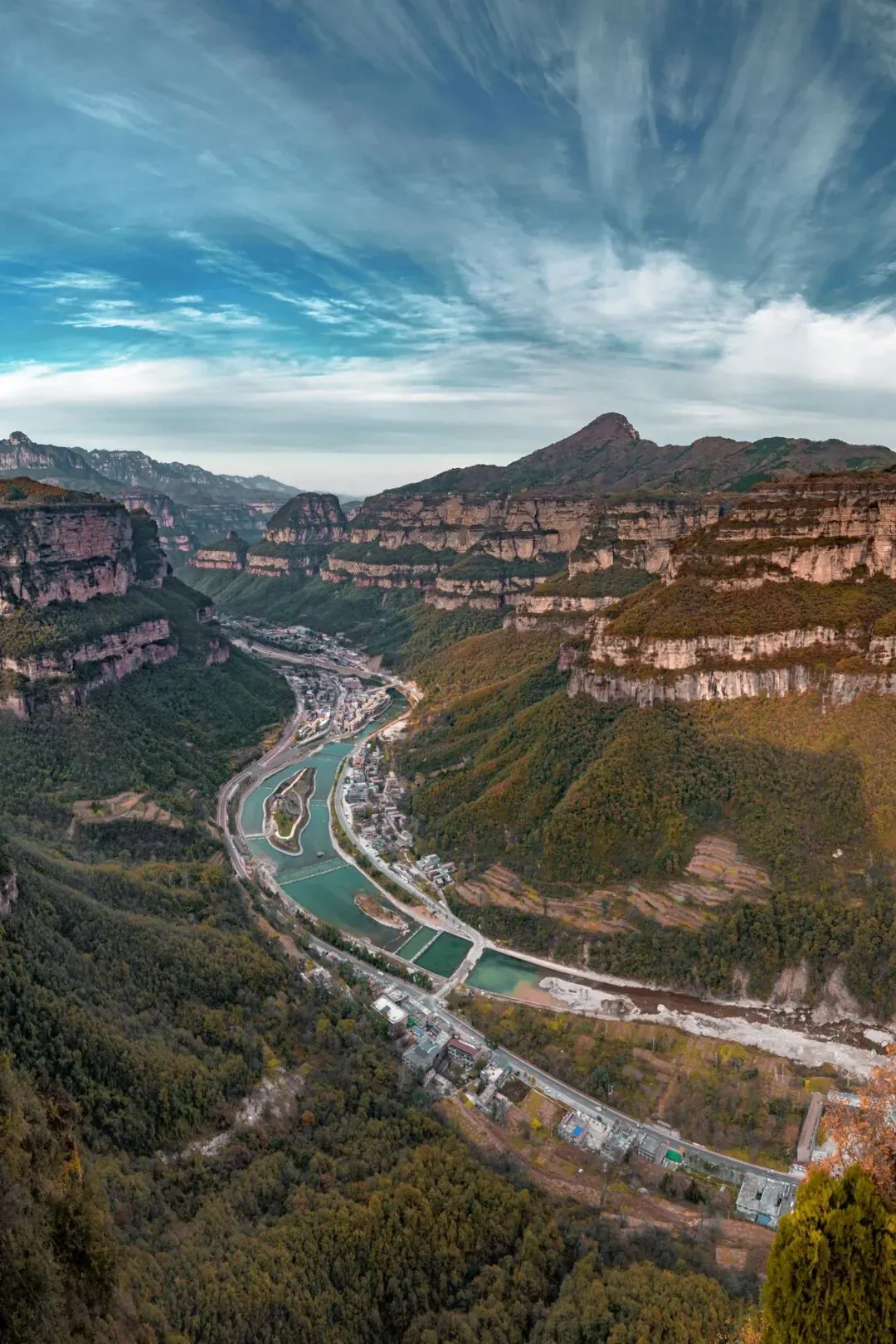
Anyang Taihang Grand Canyon is both a water route and a passage.
Leveraging the significant elevation difference between the Shanxi Plateau and the North China Plain, rivers such as the Qin River, Zhang River, Hutuo River, Sha River, Tang River, Juma River, and Yongding River cut across the main range of Taihang Mountain and flow into the North China Plain, creating vast fertile lands.
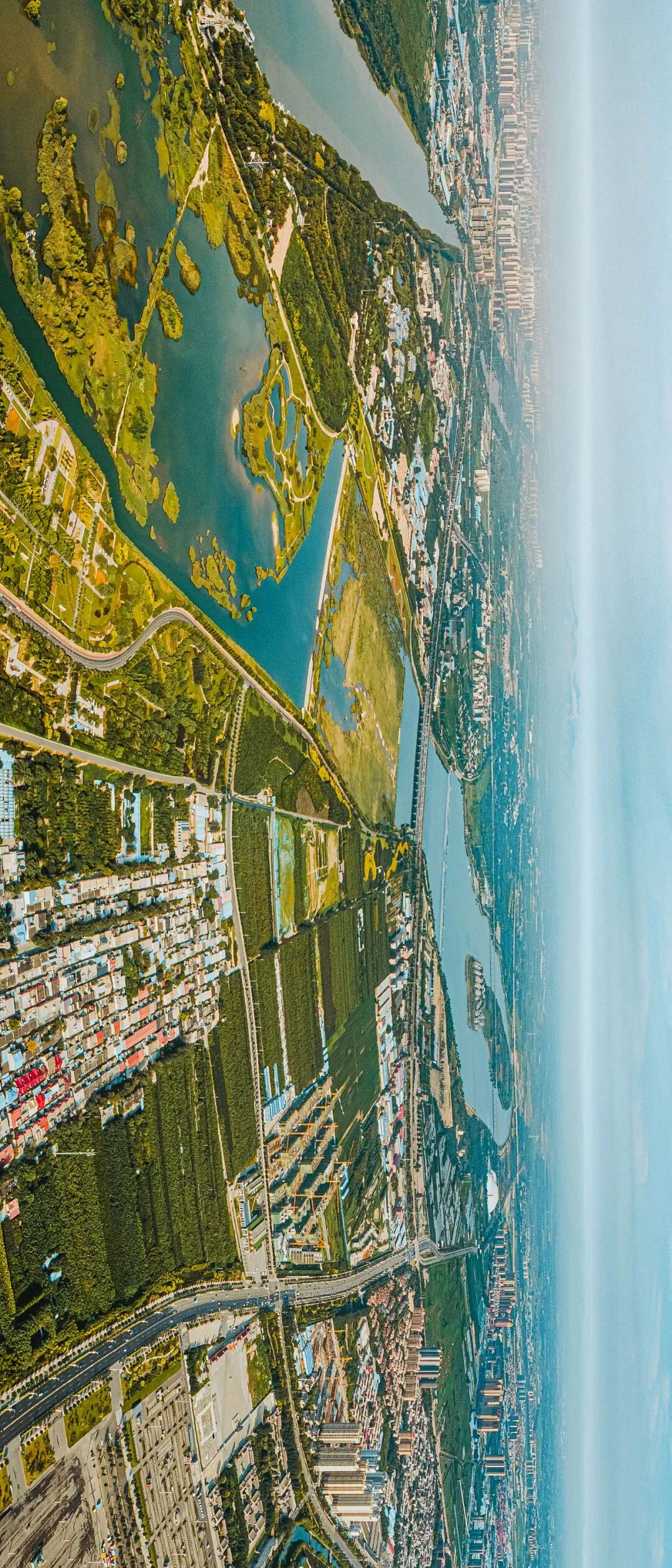
The Hutuo River flows from Taihang Mountain into the North China Plain, nourishing all things.
These rivers that cut through Taihang have carved out many water gaps in the mountain range. These gaps, along with natural passes on the mountains, have become important passages.
A golden route connecting Shanxi with Henan and Hebei.
There are eight famous water gaps and passes in Taihang Mountain, collectively known as the "Eight Passes of Taihang".
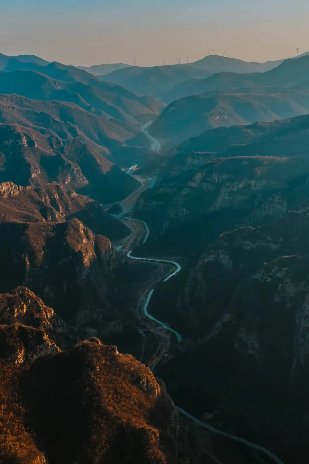
One of the Eight Passes of Taihang: Feihu Pass.
The places where mountain ranges are interrupted are called "Xing," which is a highly distinctive topographic dialect in the area around the Taihang Mountains.
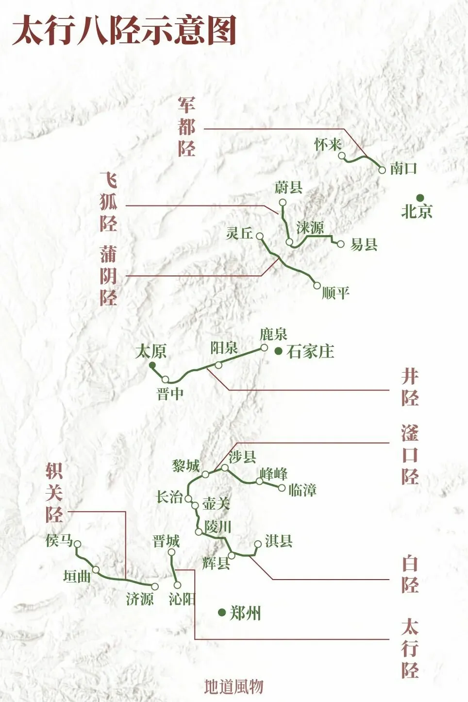
The Taihang Mountains are not particularly high. Although they served as a barrier between Shanxi and the North China Plain for the ancients, they did not form a distinct divide.
For over two thousand years, the Taihang Mountains have often been a region where different civilizations and political forces clashed and merged. During such times, the "Eight Xing of Taihang" were not only passages for goods and people but also golden routes in the eyes of strategists.
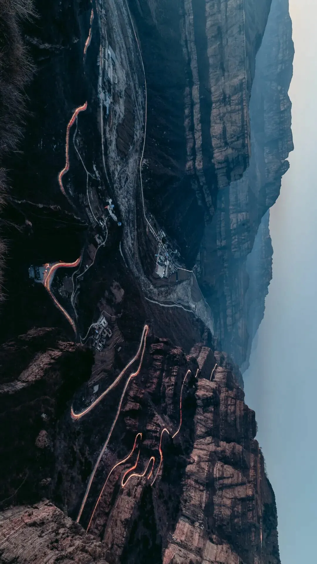
Linzhou, Henan: the roads of the Taihang Mountains wind endlessly.
Jingxing, one of the "Eight Xing of Taihang," is still used as the name of a county today. It was once a vital transportation route from Shaanxi and Shanxi to the capital, and now the Shitai Highway and Shitai Railway still run alongside Jingxing.
According to statistics, more than 50 wars have taken place in the Taihang Xing throughout history, 11 emperors have visited the Taihang Xing, and over a hundred literati have left nearly 200 poems and literary works about the Taihang Xing. It was at the Jingxing Pass that Han Xin fought a "back-to-the-river battle." Cao Cao entered Shanxi via the Fukou Xing and launched the Huguan Campaign. Emperor Yingzong of the Ming Dynasty exited the Juyong Pass for his northern expedition, taking the Jundu Xing.
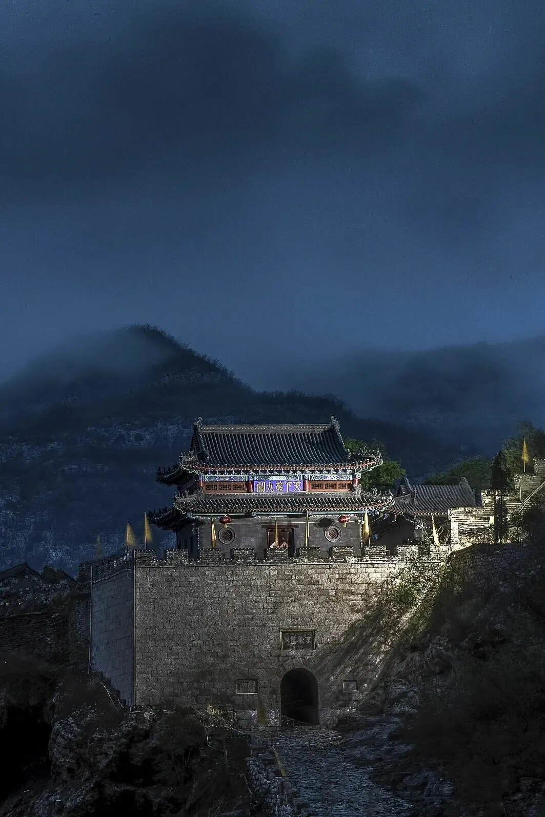
The Niangzi Pass faces the Jingxing Pass across the mountains, guarding the Jingxing Pass of the Taihang Mountains.
Due to the importance of these passages, every move of the Taihang Mountains affects the nerves of Shanxi, Henan, and Hebei.
The significance of the Taihang Mountains is by no means limited to the mountains themselves. The mountains and waters of the Taihang Mountains have created a great stage for the birth and prosperity of numerous surrounding civilizations.
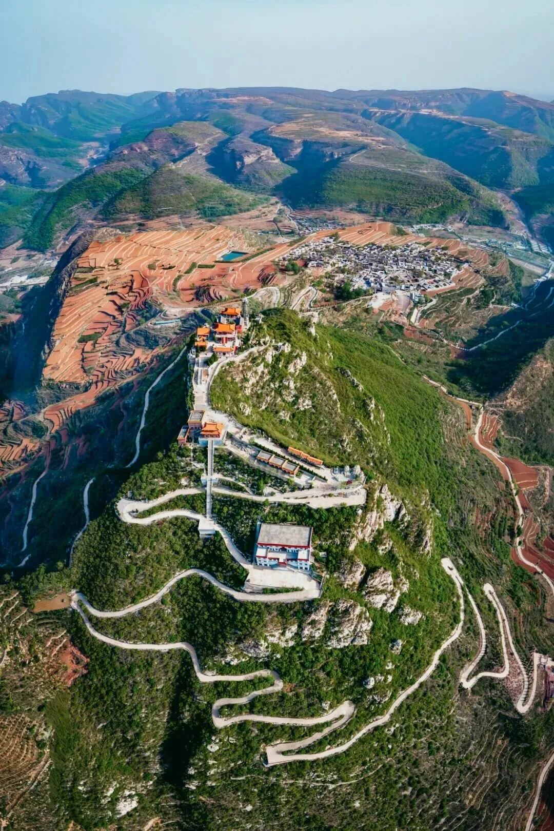
The Grandmother Temple on Hongfeng Mountain in Chaiguan Township, Xingtai, Hebei, stands atop the mountain.
It was due to the intense uplift of the Taihang Mountains, the continuous erosion and movement of soil in the west, and the constant land reclamation in the east that many basins around the Taihang Mountains and the North China Plain were formed, becoming ideal homes for people.
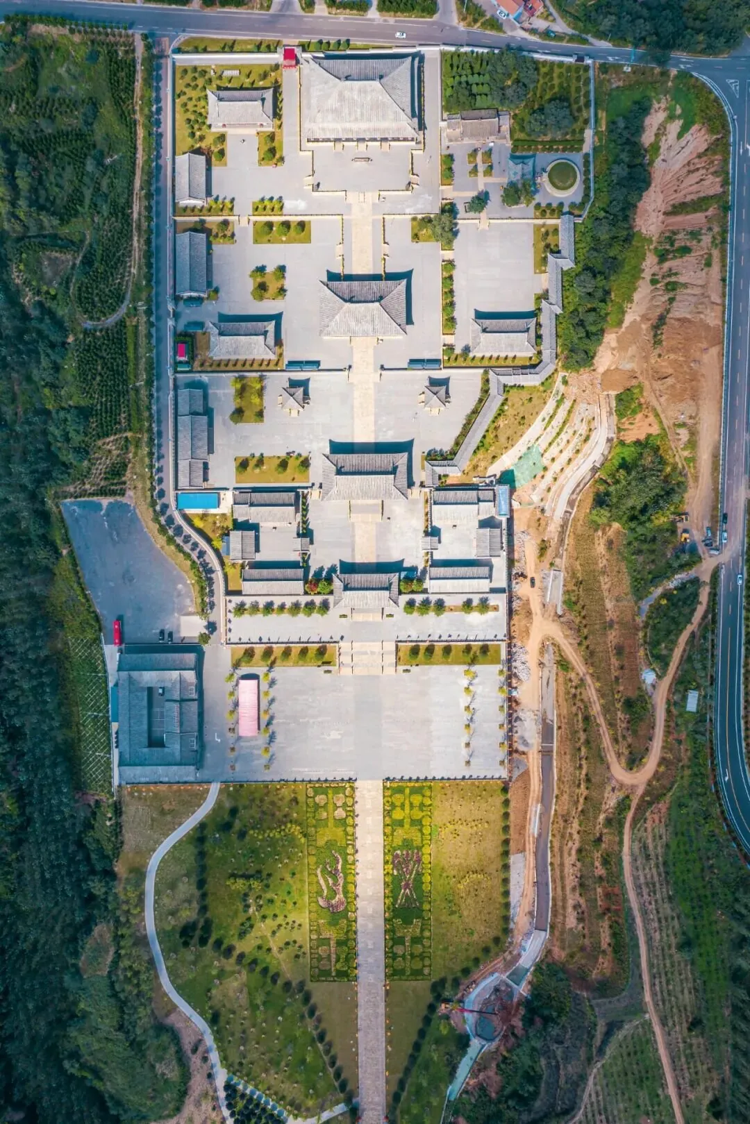
The Yan Emperor Mausoleum in Jincheng, Shanxi, is a vast cultural relic of Yan Emperor culture.
Numerous rivers cut across the Taihang Mountains, forming alluvial fans near the mountain exits. Together with the sediments of the ancient Yellow River, they created the fertile expanse of the North China Plain. The Fen River, the largest tributary of the middle reaches of the Yellow River, developed and originated within the two major radial tectonic systems of the Taihang and Lüliang Mountains, nourishing the richest Fen River Valley in Shanxi.
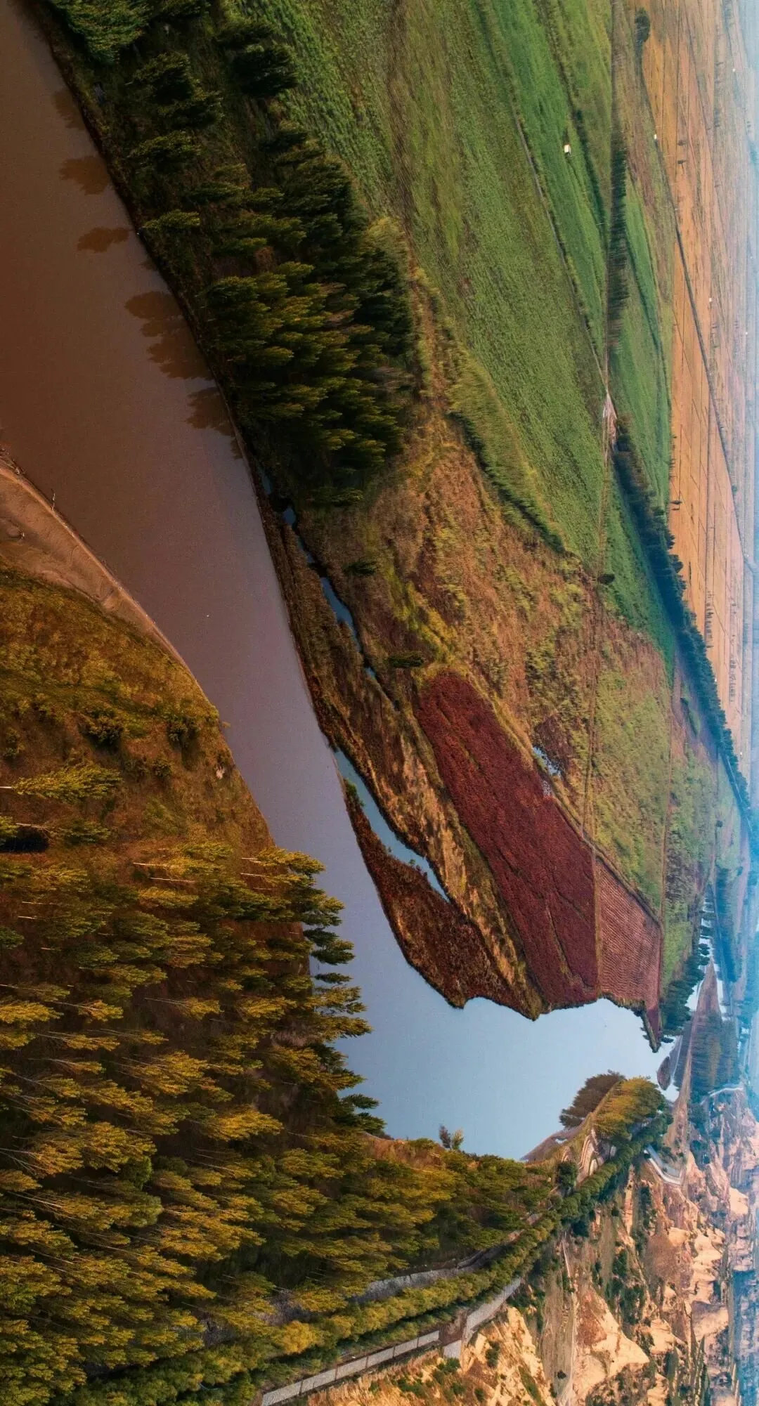
The fertile Fen River Valley nourishes Chinese civilization.
The Taihang Mountains are like the mother of the North China land.
In Shanxi, a series of basins, such as Xinding, Taiyuan, Linfen, and Yuncheng, were formed between the Lüliang Mountains and the Taihang Mountains, along with the Changzhi and Jincheng basins in the low mountain belt. In areas like Huguan and Lingchuan in Shanxi, there are many place names containing the character "Zhang," such as Shuzhang, Shizhang, Jiaozhang, Mazhang, Dongzhang, Xizhang, and Jinjiazhang, which are highly regional. The character "Zhang" means a low-lying area at the head of a gully.
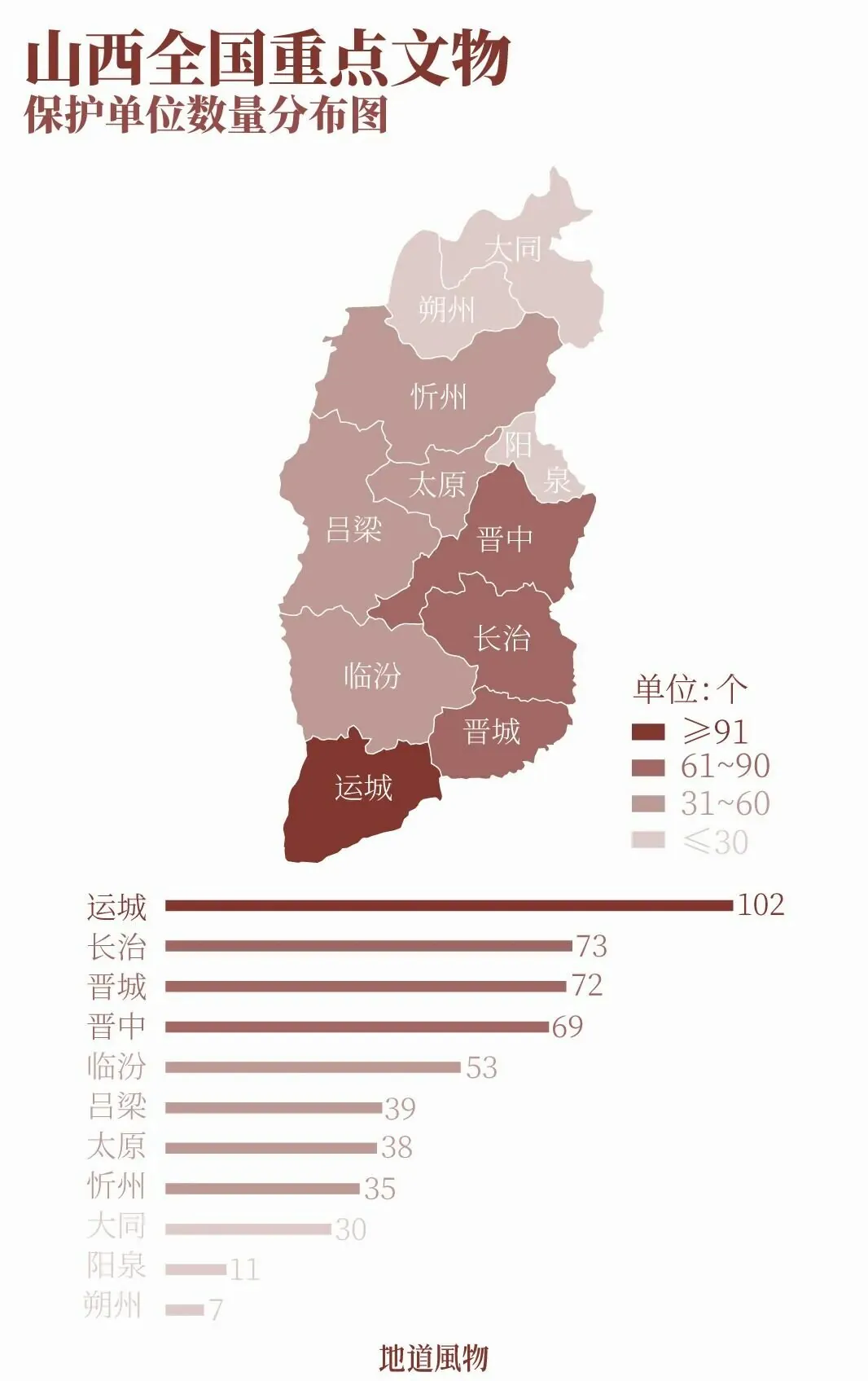
Distribution of National Key Cultural Relics Protection Units in Shanxi.
The data shown in the figure are approximate; combined projects may cause minor variations.
People gathered and settled in these rare flatlands, and the geographical features brought by the Taihang Mountains became the most direct recognition of their homeland. Basins and plains became the birthplaces and development grounds of civilization, as well as the most populous, urbanized, and economically developed areas in Shanxi, Henan, and other regions.
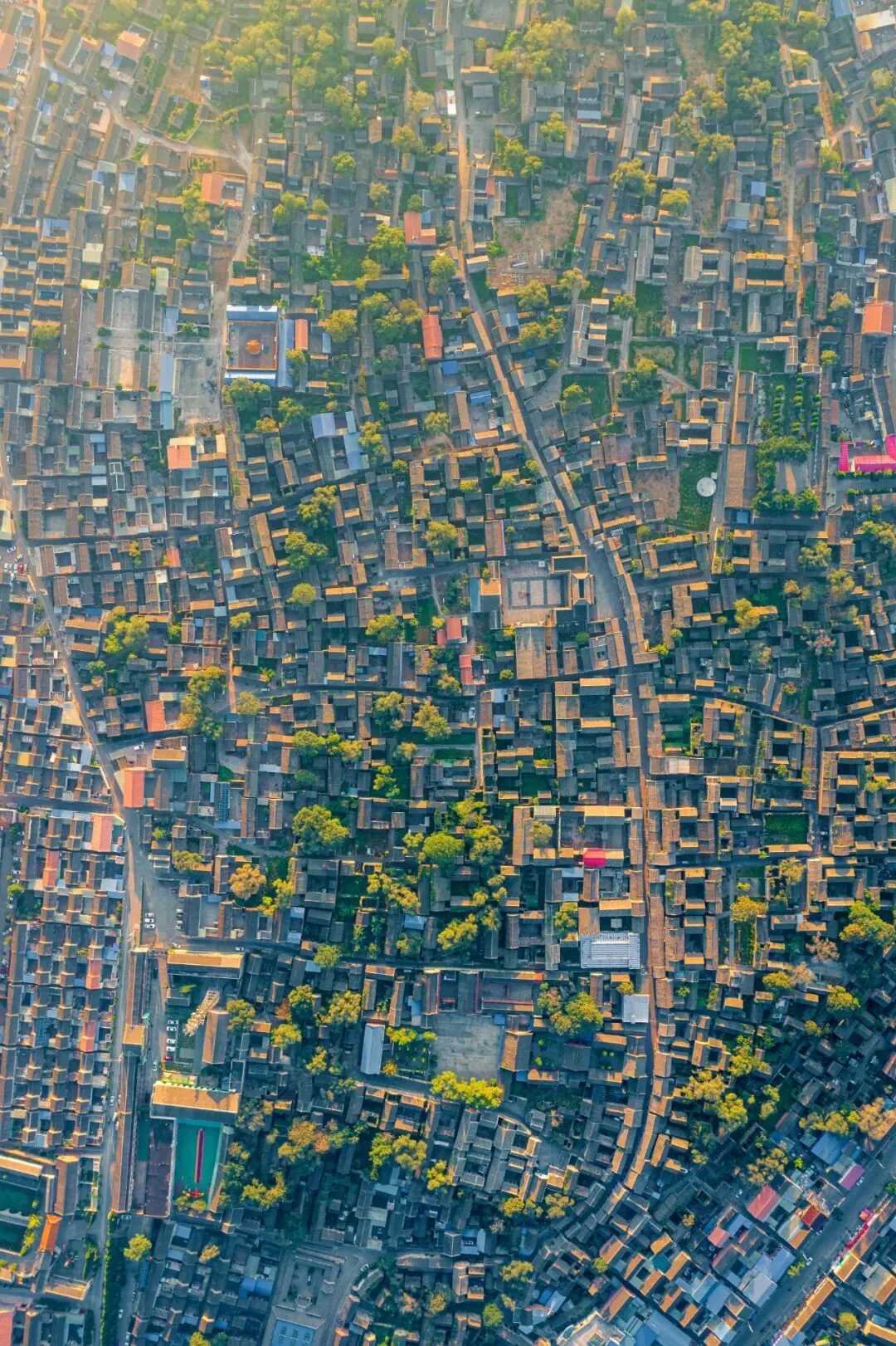
The Dayang Ancient Town in Jincheng is said to have a history of over two thousand years.
The Taihang Mountains and the Yellow River, through the force of one mountain and one river, gave names to the four present-day provinces of Shandong, Shanxi, Henan, and Hebei. Historically, this land, known as the "Central Plains," was China's earliest "land of mountains and rivers."
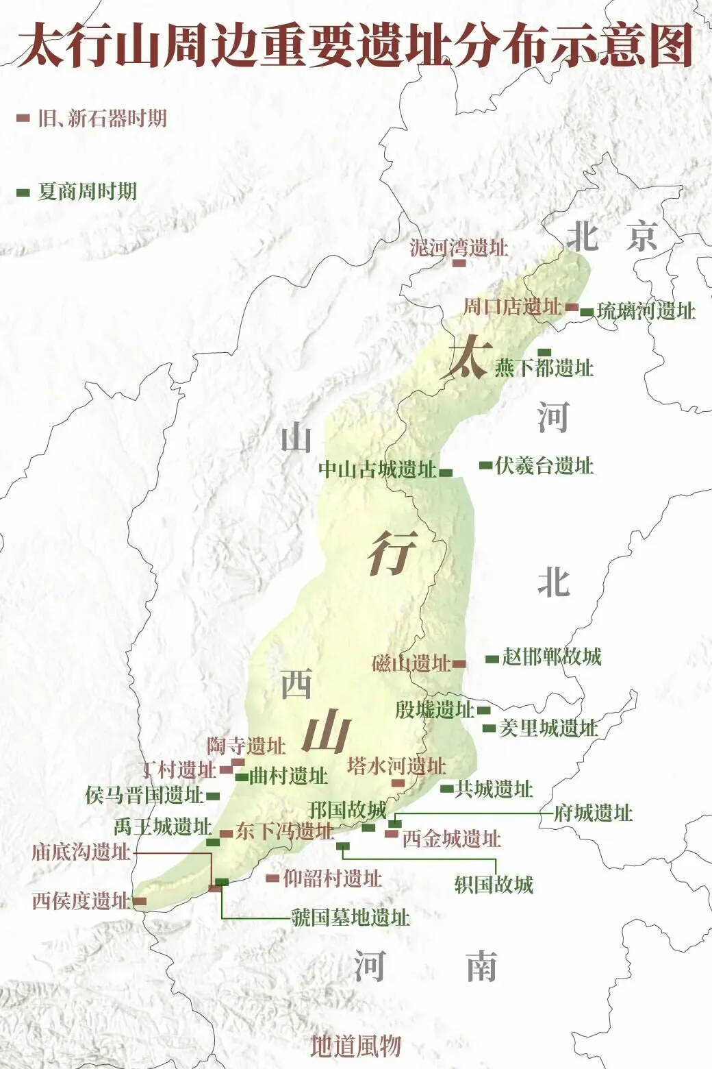
Schematic map showing the distribution of major sites around the Taihang Mountains.
The Nihewan Site, located in the Sanggan River Basin,
is one of the largest Paleolithic site complexes in China
and is considered a possible origin place of the East Asian human species.
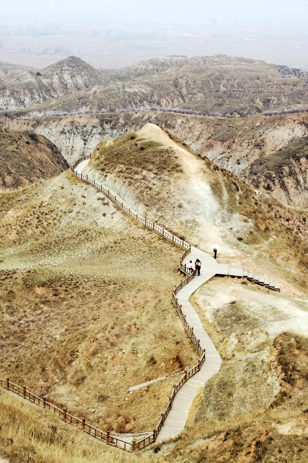
The Xiaochangliang site, part of the Nihewan Paleolithic sites, was excavated and discovered in 1978.
The Zhoukoudian Site, situated at the junction of the Taihang Mountains and the North China Plain,
is China's only World Heritage site from the Paleolithic era.
Here, humans first mastered the mystery of fire.
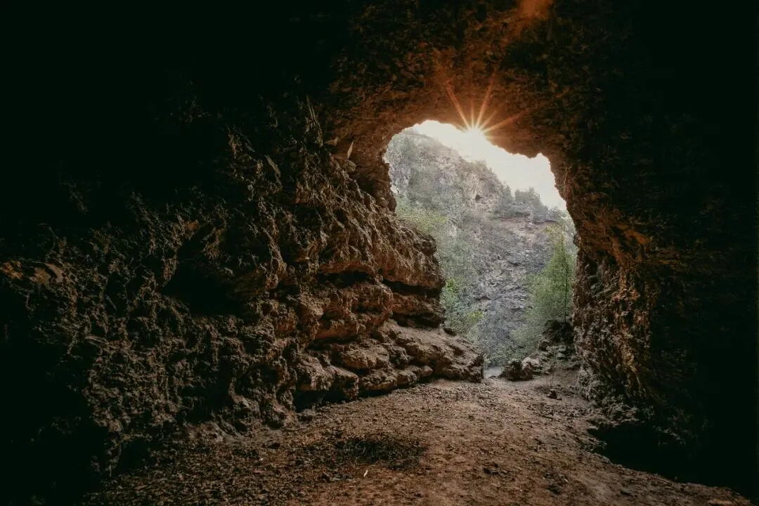
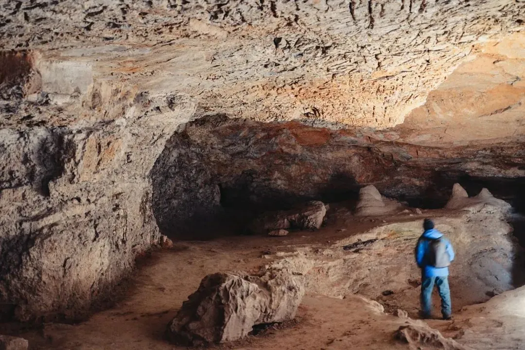
The Peking Man Site at Zhoukoudian is one of China's first World Cultural Heritage sites.
The Cishan Site, located on the eastern foothills of the Taihang Mountains,
is one of China's most important early Neolithic sites.
China is the region where millet, walnuts, and domestic chickens were first cultivated and domesticated in the world.
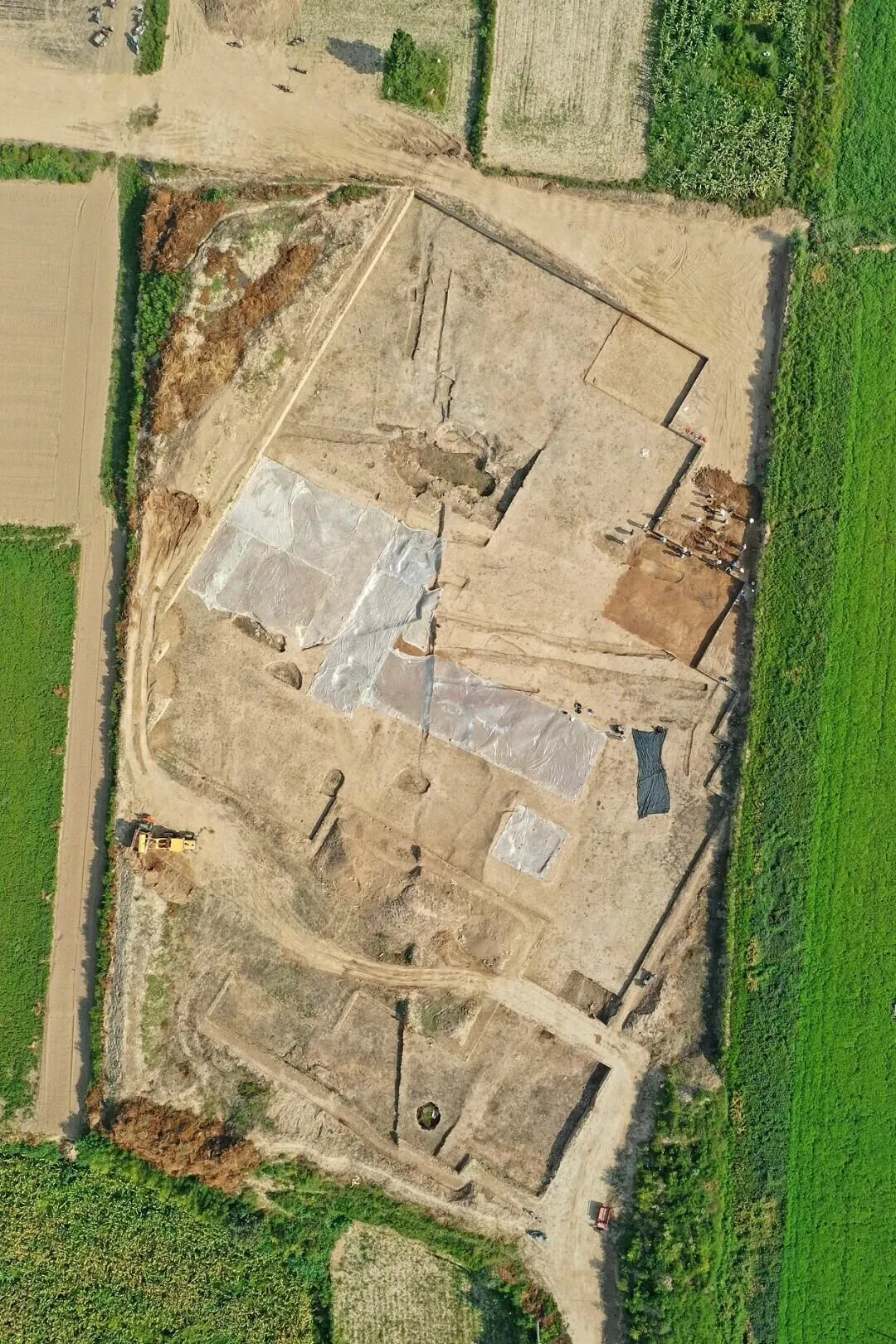
The Taosi Site, situated on the western foothills of the Taihang Mountains,
witnessed the emergence of civilizational elements such as cities, bronze, and writing.
Some scholars believe it may have been the capital of Emperor Yao.
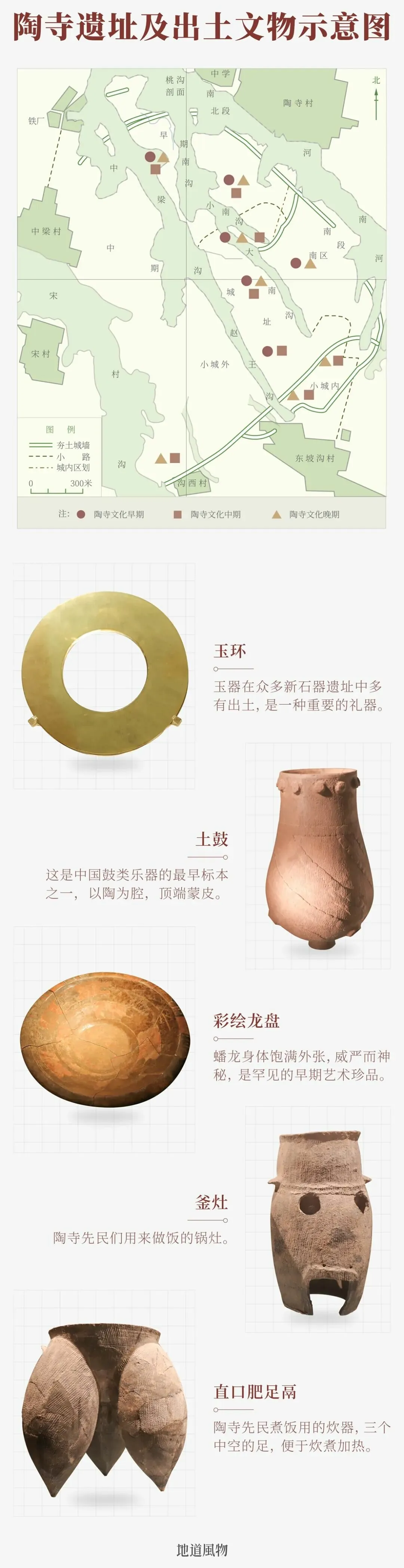
Schematic diagram of the Taosi Site's scope and unearthed artifacts.
In early times, the Taihang Mountains were endowed by the Chinese with mythological imagery of creation, also known as Mount Wuxing, Mount Wangmu, and Mount Nüwa. Here, the Chinese constructed a cosmic order from a Chinese perspective and explored the mysteries of the origins of civilization.
Legend says Nüwa molded humans from clay and mended the sky with melted stones here—the Wa Palace in She County commemorates this serpent-bodied creation goddess. King Cheng Tang of Shang prayed for rain in the Mulberry Forest here; in later folk tales, he transformed from an emperor into a rain god. Houyi shot down the suns here, Jingwei filled the sea here, Yugong moved mountains here, and Shennong tasted hundreds of herbs here...
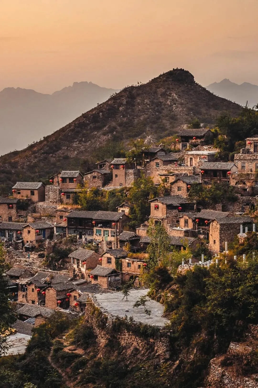
In Yangquan City, Shanxi Province, many houses in Liangjiazhai, Yu County, are built with stone.
The eastern and western flanks of the Taihang Mountains formed two brilliant ancient city belts, from the Shang Dynasty to the Han Dynasty, countless fang states, kingdoms, and vassal states emerged among them. In the Fen River Valley at the western foot of Taihang, cities like Jinyang, Pingcheng, Houma, Jiang, and Pingyang all chronicle the dramatic changes since the Spring and Autumn and Warring States periods.
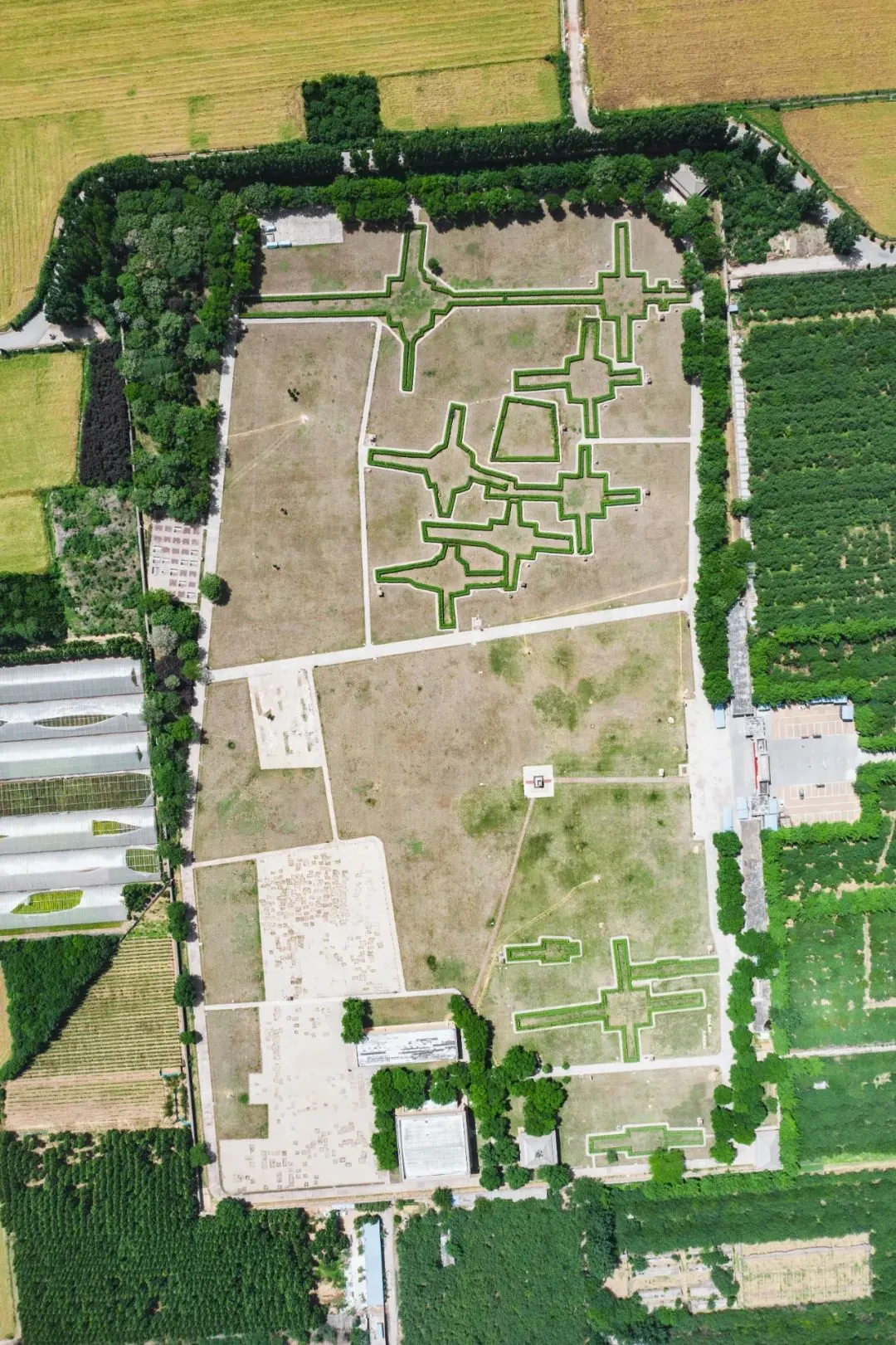
The Yinxu site in Anyang, Henan, was a large-scale capital of the Shang Dynasty.
In the areas of Henan and Hebei to the east of Taihang, such as Zu Yi moving to Xing, Pan Geng capitalizing at Yin, and later Anyang, Lingshou, Handan, Yecheng, and Beijing, it's almost a history of Chinese cities from the Xia and Shang dynasties to the Ming and Qing dynasties.
With such a long historical accumulation, along with suitable geographical and climatic conditions, the Taihang Mountain region has become one of the areas with the highest density of ancient Chinese architectural remains.
Top: Nanchan Temple; Middle: Guangrenwang Temple; Bottom: Kaiyuan Temple
Top photo by Shi Yaochen; Middle and bottom photos by Luke
All three existing Tang Dynasty wooden structures in China are located within the broad Taihang Mountain system: Nanchan Temple is one of the oldest wooden structures in Asia; Foguang Temple was highly praised by Liang Sicheng as China's "first national treasure"; Guangrenwang Temple is the only existing Tang Dynasty Taoist building in China. Even the remaining "half" Tang structure, the Bell Tower of Kaiyuan Temple in Zhengding, is at the exit of Jingxing, facing the Taihang Mountains from within the ancient city.
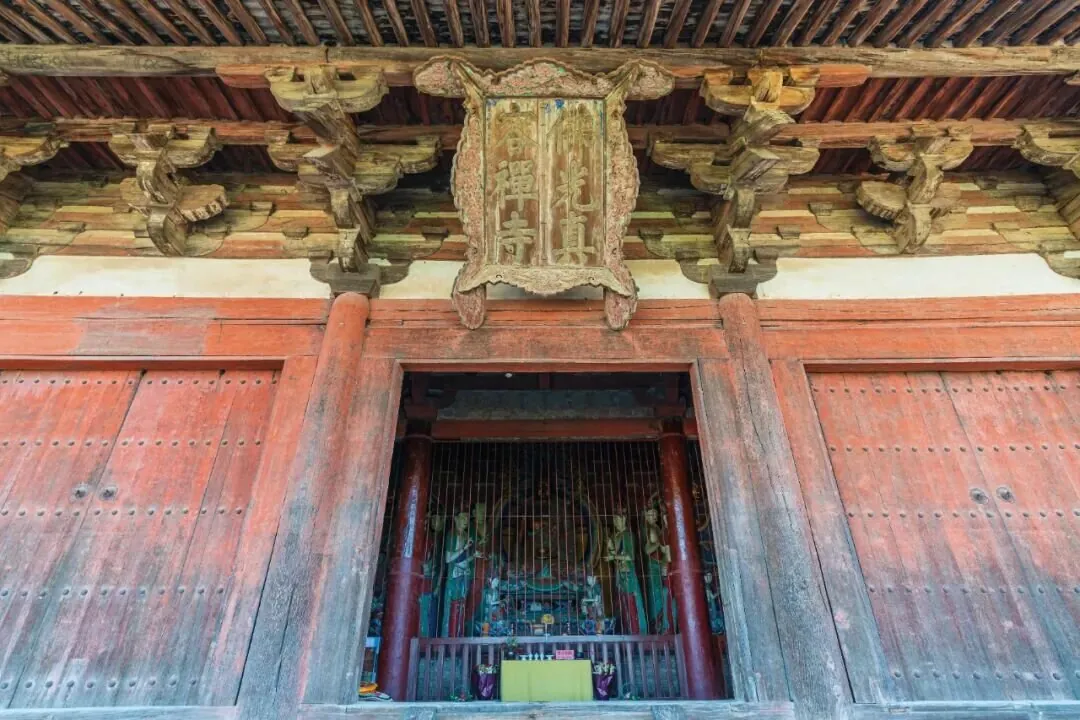
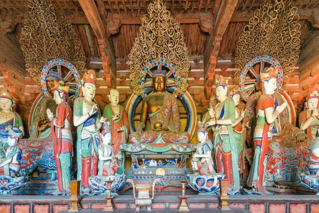
Top: Foguang Temple; Bottom: Tang Dynasty sculptures inside Foguang Temple
The Shangdang region in the heart of the Taihang Mountains is a treasure trove of ancient architecture. According to statistics by ancient architecture expert Chai Zejun, "There are 80 known ancient buildings from before the Song, Liao, and Jin dynasties in the ancient Shangdang region, accounting for half of the national total." Examples like Tiantai Hermitage in Pingshun, Qinglian Temple in Zezhou, Faxing Temple in Zhangzi, Yuhuang Temple in Fucheng, Kaihua Temple in Gaoping, and Huangcheng Xiangfu in Yangcheng are all highly representative ancient buildings of their time and region.
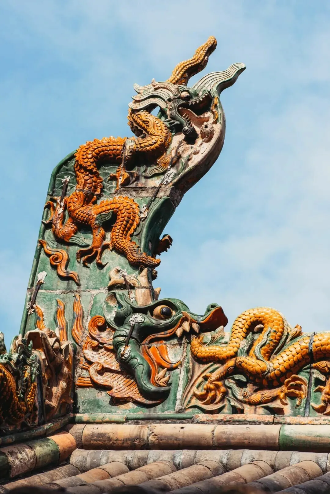
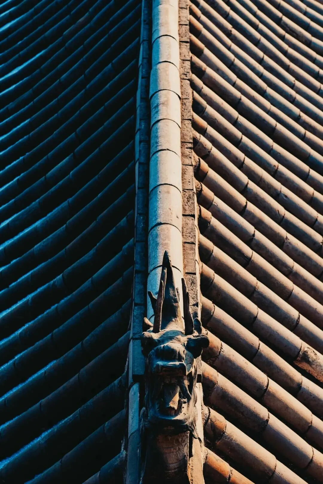
Components on ancient buildings in Jincheng, Shanxi, with glazed sculptures vividly crafted.
No other mountain range is surrounded by so many ancient capitals and famous cities, with such a wealth of cultural relics. The Taihang Mountains are the backbone of Chinese civilization, truly the axis of civilization.
For every Chinese person, as long as you know "Yu Gong Moves the Mountains," you know the Taihang Mountains.
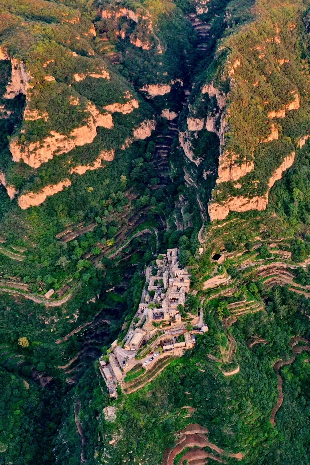
Yuejia Village in Changzhi, Shanxi, located on a cliff.
"In May, we call to each other to cross Taihang, without complaining about the hardship of the winding paths," Li Bai's verse describes the difficulty ancient people faced traversing the "Taihang Xing"; Su Shi also lamented, "Feihu and Shangdang are the spine of the world, half-veiling the setting moon before dusk," likening the majestic Taihang Mountains to the backbone of the world.
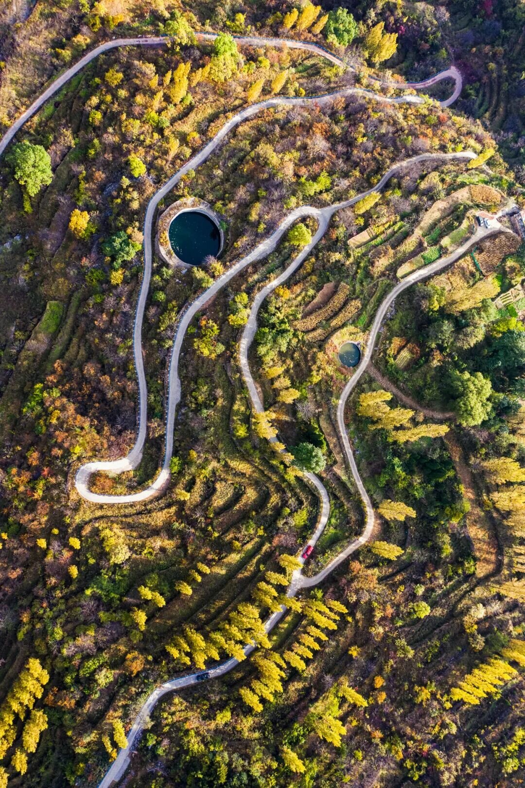
Winding roads allow people to traverse the Taihang Mountains more quickly.
Although modern people may see the Taihang Mountains as far less towering than the Himalayas, Hengduan Mountains, or Kunlun Mountains, to our ancestors, Taihang was tall, majestic, and nearly insurmountable—the first great mountain they faced. Thus, crossing Taihang became a symbol, a spirit of perseverance and overcoming difficulties.
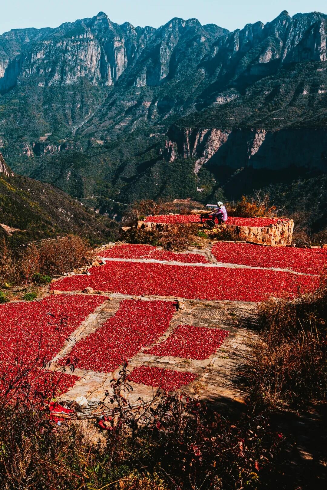
Bingbu Village in Nantaihang, Huixian County, Henan—the majestic Taihang also has patches of red.
In September 1937, it was in the Taihang Mountains that the Eighth Route Army achieved the "Victory at Pingxingguan," the first major victory since the outbreak of the War of Resistance. The Eighth Route Army quickly established the Jin-Cha-Ji Anti-Japanese Base in the Taihang Mountains, and guerrilla warfare originating here spread to other regions. Using "millet plus rifles" to defeat airplanes and artillery is a modern myth of Taihang, as well as the indomitable spirit of resistance in the mountains.
Today, people build roads and bridges in the Taihang Mountains, continuing the modern fable of "Yu Gong Moves the Mountains."
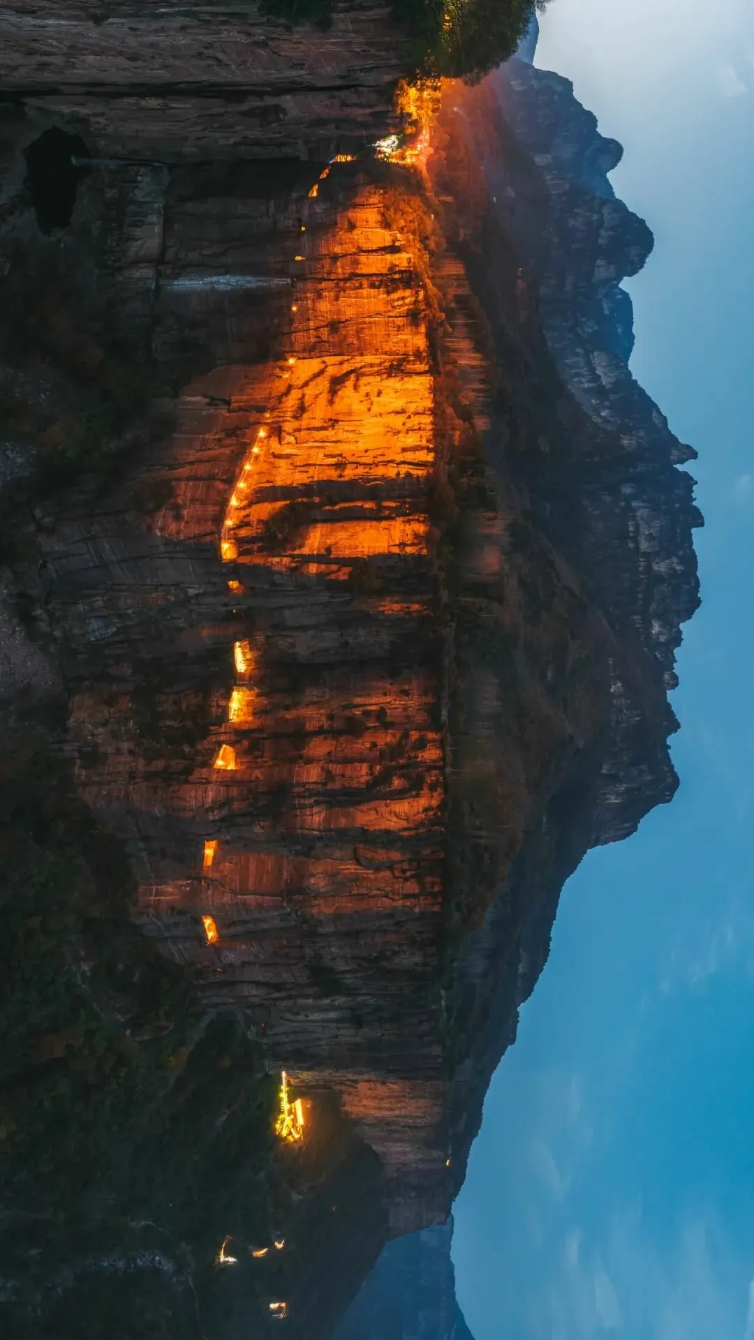
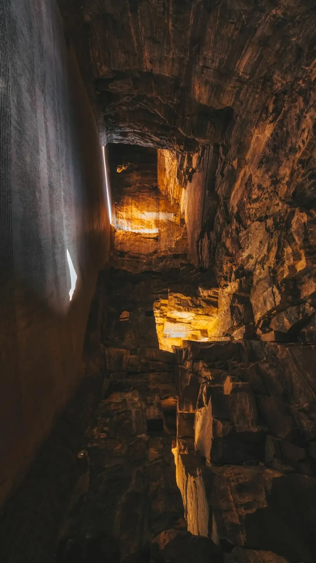
The Guoliang Village Cliff Road in Henan and its interior, resembling a "sky road."
Once, the Guoliang Village, perched on a 200-meter vertical cliff, was only connected to the outside world by a 720-step "Stairway to Heaven." The villagers of Guoliang carved an astonishing "cliffside highway" into the sheer rock face, turning a natural chasm into a thoroughfare. In the southern Taihang Mountains, at the border of Shanxi and Henan provinces, cliffside highways such as those at Guoliang, Xiyagou, Huilong, Kunshan, and Chenjiayuan have been built, forming a spectacular sight deep within the Taihang Mountains.
In the 1960s, 100,000 rock blasters from Linzhou spent nearly a decade chiseling through cliffs and digging a thousand-li canal, creating the Red Flag Canal on the precipitous slopes of the Taihang Mountains. This "man-made sky river" diverted water from the Zhang River to Linzhou, alleviating local drinking water and irrigation shortages. It became one of the "Two Great Miracles of New China" praised by Premier Zhou Enlai.
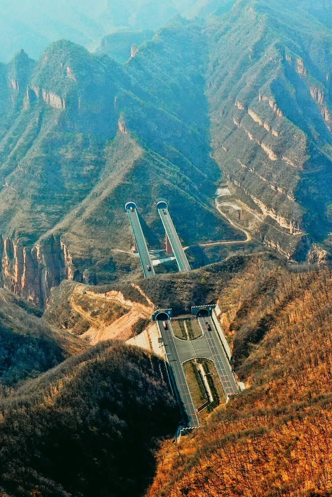
Tunnels and bridges have made crossing the Taihang Mountains convenient.
The Xianshen River Bridge, opened to traffic in 2008, has a total pier tower height of 212 meters, ranking first in Asia and second in the world among bridges of its type. The bridge rises from the bottom of the Xianshen River Valley, stretching its arms toward the cliffs on either side, connecting traffic between Henan and Shanxi.
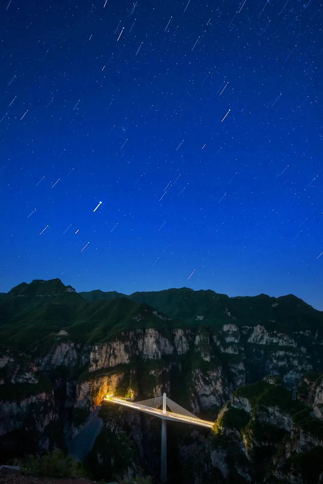
The Xianshen River Bridge: a splash of color deep in the mountains.
The Taihang Mountain Tunnel, which passes through the Taihang Mountain range at an altitude of 1,311 meters, is the third-longest tunnel in China. It brings Shanxi and Hebei closer together and stands as a significant milestone in the history of China's railway tunnel construction.
"The He Tu · Kuo Di Xiang" states, "Taihang is the spine of the world." The unique geographical and geological features of the Taihang Mountains have shaped the opportunities and challenges this mountain range presents to people.
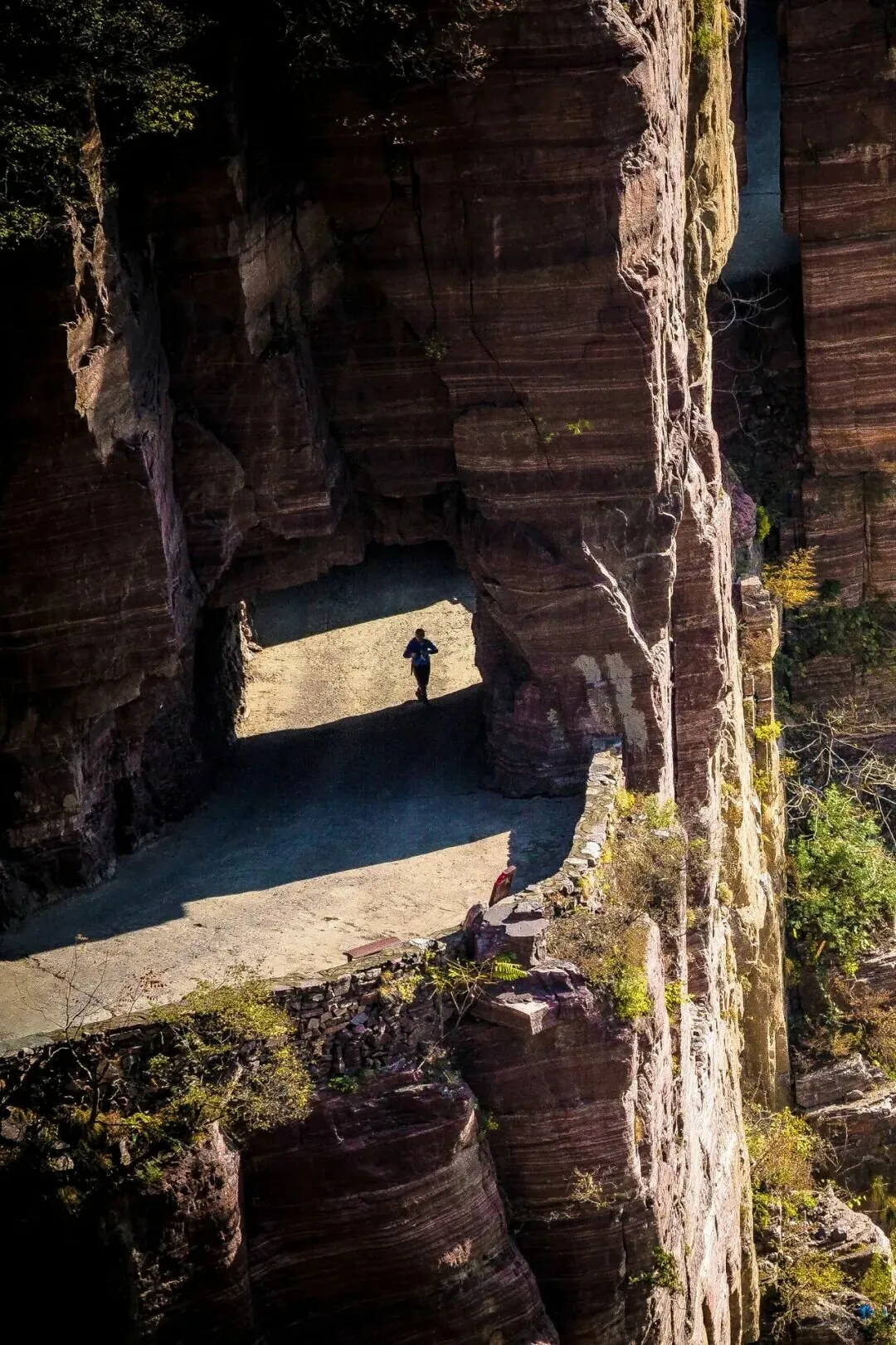
Travelers walk along the cliffside highway to reach Guoliang Village atop the cliffs.
Yet, from history to the present, our response to the majestic Taihang Mountains has been characterized by the perseverance of the Foolish Old Man who moved mountains, the hard work of turning chasms into thoroughfares, the collective effort to dig canals and divert water, and the unity in facing floods.
Text by Luke, Nuts
"The Cultural Connotation and Utilization of the Taihang Mountain Cultural Belt," by Ji Shengli
🔍 Explore More
How Did China's Smallest City in Shanxi Give Birth to the Universe-Level Epic The Three-Body Problem?
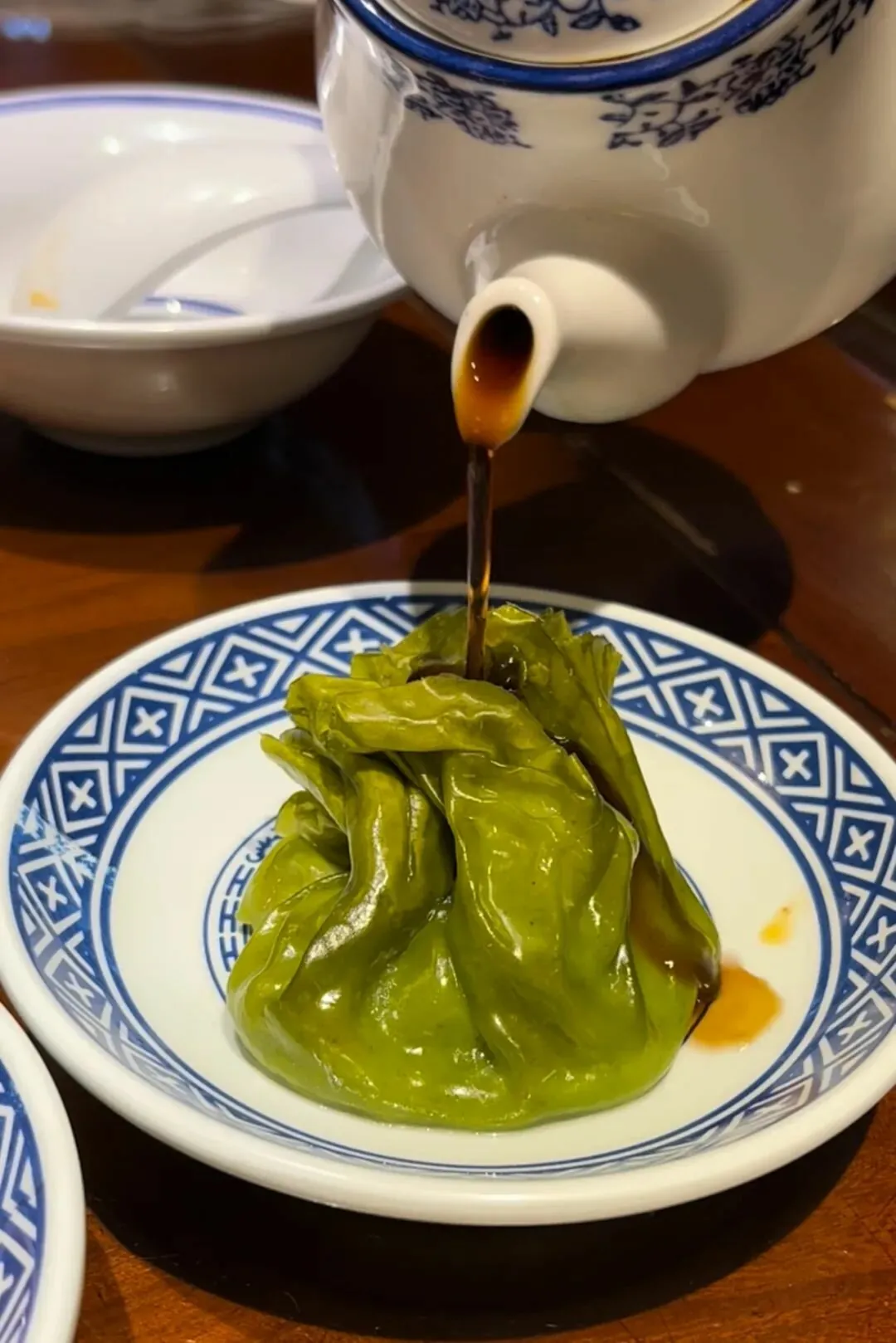
A Bite of Burger, A Sip of Vinegar: How China's Sourness Capital Came to Be